Level 5 Cyclone Yasi to hit north Queensland, Australia, 2 Feb 2011

Flakes

New Member
Joined
Jan 6, 2011
Messages
269
Reaction score
29
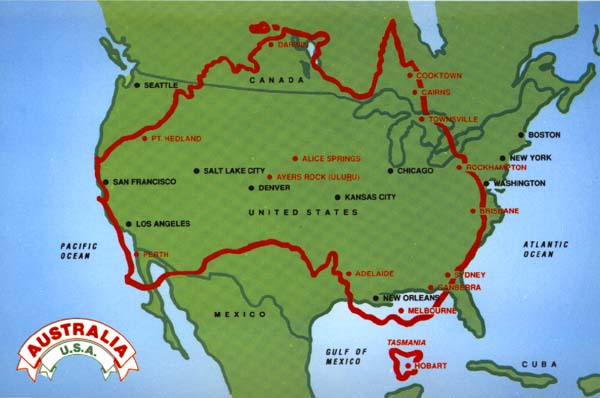
Australia is preparing for another barrage of destruction today with the upgrade of Cyclone Yasi from High Level 4 to Level 5. The expected time for the cyclone to hit the coast of Queensland is 10pm (Queensland Time), which coincides with high tide. This combination will increase the impact severely. Winds are expected to reach 320km/hr (approx 200mph), and owing to the high tide there is an anticipated surge of water to 7m (approx 23 feet). Weather bureau has warned that the storm will be devastating to the region between Port Douglas and Townsville. Cairns has had large evacuations, with people being urged to flee to safe locations without their belongings.

Full Coverage:
http://www.theage.com.au/environment/cyclone-yasi

Live Blog:
http://www.theage.com.au/environment/weather/cyclone-yasi-live-blog-20110202-1acsz.html

IDY00030.201102011800.png


cyclone.gif


What is a "Cyclone"?
From the Weatherzone website:
In the southern hemisphere the name “tropical cyclones” is used and in the Northern Hemisphere, they are called “hurricanes”.

Both hurricanes and typhoons are tropical cyclones. A hurricane is a severe tropical cyclone originating in the equatorial regions of the Atlantic Ocean or Caribbean Sea, traveling north, northwest, or northeast from its point of origin, and usually involving heavy rains.

Typhoon is applied to intense tropical cyclones, which occur in the western Pacific Ocean. In Australia the terms "Tropical Cyclone" and "Severe Tropical Cyclone" are used.

http://www.weatherzone.com.au/help/article.jsp?id=71
 
HOLY COW! Duck and cover!
The weather is totally outta control. It's crazy here and Lake Michigan is supposed to get to 18 feet. That's basically unheard of in the winter...much less any other time.

Run for high grounds and stay safe there!!
 
Major evacuation centres in Cairns are full, and authorities have announced if people have not left their homes already, then they are too late to do so at this stage. Trees along the coastline are already starting to succumb to the winds. It is predicted damage from the water front caused by the high tide + winds will be greater than the wind damage itself. The cyclone is expected to continue through as far inland as Mt Isa, and into the Northern Territory (the state to the west of Queensland).

I have friends on the coastline of Cairns who have sent us emails saying they're staying put at their property (they operate a popular tourist bar). It makes all of us very nervous to read that! They plan to congregate in the guest-room bathroom covered in mattresses. Nervous times!

Cyclone Yasi occupies position #6 on twitter at this stage, I expect it to rise as the disaster progresses. The hash tag appears to be #TCYasi – meaning Tropical Cyclone Yasi.

Yellow diagonal line at left marks the Queensland coast at the time of my posting:

yasijapan.jpg


Just so you can see the sense of humour that prevails amongst Australians, even in moments of imminent disaster, here is a snapshot:

yasigraff.jpg
 
[from the link]This timelapse uses false colour infrared imagery from JMA's MTSAT geostationary satellite & radar data from the Australia BoM to track the path of the Tropical Cyclone Yasi as it forms and heads towards the Queensland Coast. It has passed directly over the Willis Island radar which allows the Eye to be clearly seen by the radar and satellite imagery, and has now formed into a category 5 storm. It is expected to make landfall around 10pm tonight AEST.

For the latest satellite imagery please visit For the most current versions of this satellite imagery see http://www.theweatherchaser.com/

Follow @weatherchaser on twitter for updates.

[video=youtube;daJRmJnKGQc]http://www.youtube.com/watch?v=daJRmJnKGQc[/video]
 
wow...this weather....pretty soon up will be down and wet will be dry....:eek:
 
To all our Aussie WSer's, stay safe and check in when you can.
 
wow...this weather....pretty soon up will be down and wet will be dry....:eek:

That's so true. This is normally the time of year that Australia is dry, and burning out of control – especially the south-eastern-most states. You may remember Black Saturday, 7th February 2009? Bushfire burned over 4,500 km² (450,000 hectares, 1.1 million acres) in the state of Victoria, with 173 dead, 414 injured, 3500+ structures damaged, over 2000 houses lost. The fires broke out after a long, torturous heat wave, where temperatures were in the mid to high 40°C (approx. 110–120°F) and wind speeds in excess of 100 kilometres per hour (62 mph). At the same time, there were horrific fires in New South Wales, the state that sits between Victoria and Queensland.

This year it is the opposite. We have seen widespread flooding. Queensland and Victoria have both been hit with disasters in the last weeks. Queensland has seen damage above $3.5 billion and Victoria over $2.5 billion (in Australian dollars which are running pretty much neck-and-neck with the US and Canadian dollars atm). Flooding is still occurring in Victoria. A few days ago there was a cyclone threat to Perth (Western Australia) which proved to be less of a drama. But now the Severe Tropical Cyclone hitting Queensland, which will once again cause flooding in Queensland. It may well do so down the east coast of the continent as there is likely to be tremendous rain. Here in Melbourne (Victoria) we have just had another heat wave of unbearably hot days, and it is ready to start raining tonight.

We seem to go from one extreme to another. There are predictions that we are in for a ten year spell of high rainfall, which will be a welcome for most Australians given the alternative scenario is bushfires! The farmers are completely beside themselves though, as crops have been destroyed. This is going to play havoc with our usually plentiful supply of premium quality fresh produce. There is so much truth in the famous poem:

I love a sunburnt country,
A land of sweeping plains,
Of ragged mountain ranges,
Of droughts and flooding rains.
I love her far horizons,
I love her jewel-sea,
Her beauty and her terror –
The wide brown land for me!

verse 2 of "My Country" by Dorethea Mackellar, 1904

In contrast this is what we are usually facing at this time of year:

604966-black-saturday.jpg


And this is what we are seeing now:

86472773.jpg


Like a phoenix rising from the ashes ... Life goes on :) And we'd never want to live anywhere else.
 
To all our Aussie WSer's, stay safe and check in when you can.

I'm in Victoria so well and truly safe. I'll try and keep you all up to date on the goings on in Queensland over the next few days! We are all sitting here holding our breath right now. The suspense is torture.

For anyone interested in the Zahra Baker case – Giru, the town where she lived, is smack bang in the middle of the path of the cyclone!
 
Important message to all Americans considering travel in Queensland, from the US Embassy in Australia:

The U.S. Consulate General in Sydney encourages all Americans in Queensland to keep aware of their situation and to follow the directions of Australian emergency authorities. We urge Americans planning to visit the affected regions to review carefully their travel plans. For emergency help during storms or floods, please call 132-500. The Queensland Government’s Department of Community Safety provides helpful information at: http://www.emergency.qld.gov.au/

If you have urgent concerns or critical information about conditions in your area that you wish to bring to the Consulate’s immediate attention, please contact us at SydneyACS@state.gov, or telephone the American Citizen Services Unit at the U.S. Consulate General in Sydney during business hours at (02) 9373-9200 or (02) 4422-2201 for after hours emergencies.
 
Anna Bligh, Premier of Queensland has just warned the state that it should be prepared for "catastrophic devastation" in the next 24 hours. Very stressful times!

ETA is midnight (Eastern Standard Time) ie just over three hours from this post.

The central focus of the cyclone will hit the town of Innisfail, which was hammered by Cyclone Larry in 2006.

A live cam is broadcasting from Cairns with the support of national communications bodies (owing to the incredible number of hits to the page) at:

Cyclone Yasi - Cairns (#bigyasi) on Justin.tv

Not sure how long the visibility will continue with the cam as it's already dark and visibility is owing to street lights directly opposite the house. Cairns has already begun to lose power. At the moment it is showing huge winds in the palm trees around the house.

It is not safe for anyone to travel now.
 
Prayers for all of you in Oz - what terrifying times these are right now...........
 
This storm concerns me very much because my daughter is on the Gold Coast for the semester. Does anyone know if this cyclone will affect the Gold Coast? Between the flooding and now this... The weather is nuts. Stay safe everyone!
 
Powerful Cyclone Strikes Australia's Northeast

Witnesses reported roofs being ripped off, buildings shaking and trees flattened under the power of the winds. Officials said the storm surge would flood some places to roof level.

"This is a cyclone of savagery and intensity," Prime Minister Julia Gillard said in a nationally televised news conference as the storm moved toward the coast. "People are facing some really dreadful hours in front of them."

bbm the surge can be potentially as dangerous as the storm itself.

I truly can't imagine, alot of our members are there, praying for all of them
 
This storm concerns me very much because my daughter is on the Gold Coast for the semester. Does anyone know if this cyclone will affect the Gold Coast? Between the flooding and now this... The weather is nuts. Stay safe everyone!

In looking at google maps the Gold Coast looks pretty far away. She should be ok, I've never been there but here is a link of the map. It looks like it is hundreds of miles away. Hope this helps a bit to ease your mind.

gold coast australia - Google Maps

To add Cairns is where it was supposed to make land fall just click on the up arrow to get to Cairns, you will see how far away it is
 
Just wanted to add my thoughts and prayers to all affected...but I loved the Kiss My Yasi sign. I love the sense of humor!!

Best-
Herding Cats
 
It seems as if a miracle has occurred in Australia last night. At this stage we have no reported deaths. The Premier of Queensland Anna Bligh is not relaxing on that yet as there are communities who are at this stage unreachable, and we don't know their fate.

Searching 101 your daughter will be absolutely safe, though a little wet :) The Gold Coast is approx 1700km (1056miles) south of the core point of impact, and that is over 20 hours driving!

Cyclone Yasi hit the towns of Mission Beach, Innisfail (which suffered another devastating cylcone in 2006), Cardwell, Tully and Silkwood with it's full intensity at around midnight Qld time (1am Eastern Standard Time) last night. The large cities of Townsville and Cairns were fortunately out of the eye of the cyclone, so the damage in these highly populated areas was far less.

The cyclone is continuing inland south-westerly direction at around 40km an hour, with winds reduced to approx 100km an hour. It has been reduced to a level 3 cyclone at this stage. By this evening it will have reached Mt Isa (a key mining town), and by that stage will have reduced to severe storm warning, as opposed to cyclone warning.

To give you an idea of the size of Australia V USA, and the enormous size of Cyclone Yasi, here are a couple of maps for you to compare:

Australia and USA

aust-usa-map.jpg


Australia and Europe

austeuropemap530768545183738692420090613172159.jpg


Searching 101 you can see Brisbane located half way up the east coast of the continent at the far right hand point. Heading north you see Rockhampton - Townsville - Cairns - Cooktown. The full force was between Townsville and Cairns. As mentioned, Zahra Baker lived just inland of Townsville.

Cyclone Yasi is heading to Mt Isa, which on the map is not far from Alice Springs at the centre.

Yasi has hit the top quarter of Australia - imagine how many people this would have affected if it hit America or Europe? Fortunately our population is only about 23milion across the entire country!

The serious threat now is the flooding from hundreds of millimetres of rain. Qld was expecting rain of up to 50mm (2 inches) per hour. The rain continues now and even as far south as Melbourne (heading south from Brisbane you see Sydney - Canberra - Melbourne on the mainland) we are expecting rain for the next 4 days. AND Victoria the state of which Melbourne is the capital is still flooding from the rain a couple of weeks ago!

You could say the right 1/4 of Australia has been battered in the last few weeks by rain, flooding, and now a cyclones with further flooding. Victoria has now started to have bushfires in the limited areas that weren't flooded! There has also been a cyclone on the western seaboard near Perth this week.

The hardest hit are our primary producers. Farmers across the eastern coast, from top to bottom have been devastated by flooding in the last few weeks. Queensland is a huge banana and sugar producing state and the bananas have been completely wiped out (in peak season). Queensland's other greatest industry is tourism, and the Great Barrier Reef which we haven't heard about at this stage (hopefully it survived safely under water!).

I will upload photos once they start to make it out into the media.
 
The photos are starting to appear, so here are some amazing ones. Keep in mind, Cyclone Yasi was about 5 times the size of Hurricane Katrina, so this gives an idea of how ferocious she was! We are lucky that the points of greatest impact on the coastline were in lesser populated beach towns, so at this point there are minimal deaths feared.

Aussies – always a sense of humour!

516448491-600x400.jpg


026503-cyclone.jpg


562338-cyclone-yasi.jpg


516147649-600x400.jpg


516197391-600x400.jpg


yasi5-600x400.jpg


BUT as a final pic ... this is what's going on tonight in Melbourne, which is 2800km south of Mission Beach where Cyclone Yasi hit hardest. That is 1750 miles and 34 hours drive south of the impact of Yasi! This first flash flooding was from the small cyclone that hit Queensland before Yasi. In an hour to two we will get hit by the fallout from Yasi. So the worse is yet to come. My street is like a river, and I have many friends who's houses are flooding.

IT IS CRAZY OVER HERE!!!!!!

Here is one of our main arterial roads.

flash-5-600x400.jpg


All photos are from The Age newspaper and The Herald-Sun
 
So Cyclone Yasi finally made her way across the ENTIRE width of the continent to Perth on the western coast. Perth is the capital of Western Australia and Australia's fourth largest city. By this stage the cyclone was wind, with little rain. She hit the dry region, and this has resulted in bushfires! So far in Perth 68 houses have been lost.

303905-port-lincoln-bushfire.jpg
 
Thanks for the updates Flakes!!! I am so glad that the death toll wasn't higher from Yasi. I also feel horrible for all of the terrible weather you guys have been experiencing. I dread tornado season here in the South Eastern US and I dread hurricane season for us too... seems like the world's weather has gone nuts and is reading from the script of the movie "The Day After" or something! Glad you are OK, and I hope you guys have smooth sailing for a while.
 

Staff online

Members online

Online statistics

Members online
239
Guests online
2,565
Total visitors
2,804

Forum statistics

Threads
591,740
Messages
17,958,227
Members
228,598
Latest member
Fatbtgurlz
Back
Top