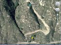
Remains.jpg is a google Earth image of where it looks like the remains were found, according to the information I have. The picture is turned sideways so North is on the right hand side and Pala-Temecula Rd is on the bottom.
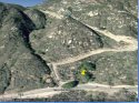
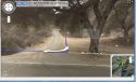
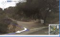
RemainsSide.jpg gives a reference to the type of terrain.
This site uses cookies to help personalise content, tailor your experience and to keep you logged in if you register.
By continuing to use this site, you are consenting to our use of cookies.