panthera
Retired WS Staff
- Joined
- Jan 4, 2006
- Messages
- 26,408
- Reaction score
- 73
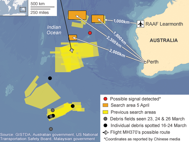
That is where my initial confusion arose from, knowing there were two ships out there (Ocean Shield and HMS Echo) that were equipped to hear the pings, and why they didn't record anything. Knowing now they weren't in the same location as the Chinese explains much. Therefore, yes, it would be interesting if those two ships moved to the same area and picked up the signal. Apparently the signal is intermittent, however, and seems it may be the FDR with the battery being very weak.Yes, still hopeful
I would like to see the other 2 ships carrying/towing a beacon locator search that same site and report it's findings
Two ships -- the Australian navy's Ocean Shield and the British HMS Echo are carrying sophisticated equipment that can hear the recorders' pings, one ship has the US Navy's towed pinger locator that can detect a ping in 20,000 ocean depth but it still needs to be within a certain range (1-2 mile i think) to be able to pick up that signal..
I thought the Chinese had a towed pinger locator but I was mistaken, what the Chinese have is a detector that was placed in the ocean just below the water surface.
I am not sure at what depth this tool can pick up the locator beacon signal but I am hopeful
MOO