
You are using an out of date browser. It may not display this or other websites correctly.
You should upgrade or use an alternative browser.
You should upgrade or use an alternative browser.
Found Deceased PA - Linda Stoltzfoos, 18, Bird-in-Hand, Lancaster County, 21 June 2020 *kidnapping arrest* #3
- Thread starter TTF14
- Start date
New Posts
-
MS MS - Dau Mabil, adult, Belhaven Heights, 25 Mar 2024
- Latest: Unalienable Rights
- Status
- Not open for further replies.

PayrollNerd
Well-Known Member
- Joined
- Feb 3, 2018
- Messages
- 17,663
- Reaction score
- 103,815
Not sure if this was posted yet.
Linda Stoltzfoos still missing 5 months later, searches continue | WHP
Snip:
Investigators are navigating a tricky timeline that started with the first report from Linda’s parents on June 21 and got more complicated when charges were filed against Justo Smoker on July 10.
“Instead of going in multiple directions you’re able to now narrow the investigation down in one clear direction, but it’s also at that point in time where the seriousness of what occurred and the events that were surrounding it make it difficult. In a sense - a tough investigation,” said Lt. Hess.
On Aug. 7, Smoker appeared in court for a preliminary hearing where he was ordered to stand trial, thus changing how investigators handle the release of information.
“Due to the nature of the events and, the incident itself we don’t release any details specific details of the case to not compromise the court proceeding itself,” said Lt. Hess.
Trackergd
Verified SAR Manager and Tracker - Retired
- Joined
- Jul 20, 2013
- Messages
- 4,371
- Reaction score
- 27,010
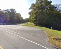
Spent a good part of today on Welsh Mountain. Lots of territory to cover and a ton of egress points. And that's just the nature preserve. Got some pictures I will post later. Mostly "Recon" today. Looking for landmark features, egress points and trails you could navigate in low light conditions. Also checked potential parking spots.
crhedBngr
Justice for Danielle Stislicki
- Joined
- Jul 26, 2015
- Messages
- 5,791
- Reaction score
- 48,583
Spent a good part of today on Welsh Mountain. Lots of territory to cover and a ton of egress points. And that's just the nature preserve. Got some pictures I will post later. Mostly "Recon" today. Looking for landmark features, egress points and trails you could navigate in low light conditions. Also checked potential parking spots.
Wonderful!!!
Thanks for your efforts.
JMVHO.
MontereyMama
Well-Known Member
- Joined
- Oct 4, 2018
- Messages
- 179
- Reaction score
- 2,023
So very thankful to see movement on this one.
Thank you for your hard work, Trackergd!
Thank you for your hard work, Trackergd!
Spent a good part of today on Welsh Mountain. Lots of territory to cover and a ton of egress points. And that's just the nature preserve. Got some pictures I will post later. Mostly "Recon" today. Looking for landmark features, egress points and trails you could navigate in low light conditions. Also checked potential parking spots.
Gosh, fabulous that you could do this. "Egress points" mean exit points from the area in question? Forgive my ignorance.
sds71
Well-Known Member
- Joined
- Aug 13, 2013
- Messages
- 13,091
- Reaction score
- 143,106
Any news on what might have happened in court - IF there was a hearing?
TIA!I'm just getting very old articles over here....
11/25/2020
CP Filed Date
Service Type eService
Filed By
Service Status Served
Ashworth, David L.
Served Served Served Served
COURT OF COMMON PLEAS OF LANCASTER COUNTY
Commonwealth of Pennsylvania v.Justo Smoker
Docket Number: CP-36-CR-0003319-2020
CRIMINAL DOCKET Court Case
11/25/2020 Order Granting Motion for Continuance
Brown, Todd Everett 11/25/2020
Encarnacion, Samuel 11/25/2020
Low, Elizabeth Adina 11/25/2020
Tallarico, Christopher Michael 11/25/2020 eService
https://ujsportal.pacourts.us/Docke...-CR-0003319-2020&dnh=leQj87YnK6aNnlFOlulmmQ==
Trackergd
Verified SAR Manager and Tracker - Retired
- Joined
- Jul 20, 2013
- Messages
- 4,371
- Reaction score
- 27,010
Entry and exit points that a car can park in or near. I wanted to figure out if he could drive a car up one or more of them. Only two are large enough and they are closed off with a bar or cable. He would have had to carry her remains into the preserve, if that's where she is.Gosh, fabulous that you could do this. "Egress points" mean exit points from the area in question? Forgive my ignorance.
Trackergd
Verified SAR Manager and Tracker - Retired
- Joined
- Jul 20, 2013
- Messages
- 4,371
- Reaction score
- 27,010
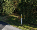
Still trying to get the pictures to upload. I noted a large number of surveyor tape markers in various colors on branches and some white direction arrows on the ground. The arrows might be from a trail ride or trail run. Woods are open with good visibility but there is a significant layer of leaves.
Fireflize
Well-Known Member
- Joined
- Feb 20, 2020
- Messages
- 1,651
- Reaction score
- 28,223
Thank you so very much. It's great to have experts like yourself dedicate to her case.Still trying to get the pictures to upload. I noted a large number of surveyor tape markers in various colors on branches and some white direction arrows on the ground. The arrows might be from a trail ride or trail run. Woods are open with good visibility but there is a significant layer of leaves.
coastal
Well-Known Member
- Joined
- May 18, 2009
- Messages
- 2,203
- Reaction score
- 4,714
Thank you so much for looking for Miss Linda, Trackergd!Still trying to get the pictures to upload. I noted a large number of surveyor tape markers in various colors on branches and some white direction arrows on the ground. The arrows might be from a trail ride or trail run. Woods are open with good visibility but there is a significant layer of leaves.
Trackergd
Verified SAR Manager and Tracker - Retired
- Joined
- Jul 20, 2013
- Messages
- 4,371
- Reaction score
- 27,010
Having now walked in the terrain and conditions, my opinion is that it would take a massive organized grid search operation to cover the mountain. Problem is that I don't know what the SAR Team did or where they searched. I also don't know what area the phone pinged in. Only LE knows that. As a SAR Manager, one of the first things you do is attempt to narrow the search area as much as possible to conserve resources and speed up the operation. Another option would be to use an eleven person team and put one person on the trail and the others inline, five to a side spaced apart and walk all the trails keeping good GPS tracking to know what trails you have covered. If JS had carried a body over his shoulder, it could not have been very far and only far enough off a trail to reduce the probability of it being seen. That ground would have required a sturdy shovel and mattock to dig through the root material. No way he was carrying her and the tools. To carry her into the woods, then go back for the tools would require one or more landmarks that would put him back in the same spot without getting lost, notably in lower light conditions. Once you go off trail, it is very easy to trip and fall on rocks and roots under the leaf litter layer. Also, Welsh Mountain is not only the nature preserve, there is a lot of other land on that mountain that is private. At least one water feature, a quarry, homes and a shooting range. Really hampers our WS group efforts if we have no cell ping location.
Trackergd
Verified SAR Manager and Tracker - Retired
- Joined
- Jul 20, 2013
- Messages
- 4,371
- Reaction score
- 27,010
Trackergd
Verified SAR Manager and Tracker - Retired
- Joined
- Jul 20, 2013
- Messages
- 4,371
- Reaction score
- 27,010
Maplesyrup
Well-Known Member
- Joined
- Feb 19, 2017
- Messages
- 347
- Reaction score
- 2,209
Having now walked in the terrain and conditions, my opinion is that it would take a massive organized grid search operation to cover the mountain. Problem is that I don't know what the SAR Team did or where they searched. I also don't know what area the phone pinged in. Only LE knows that. As a SAR Manager, one of the first things you do is attempt to narrow the search area as much as possible to conserve resources and speed up the operation. Another option would be to use an eleven person team and put one person on the trail and the others inline, five to a side spaced apart and walk all the trails keeping good GPS tracking to know what trails you have covered. If JS had carried a body over his shoulder, it could not have been very far and only far enough off a trail to reduce the probability of it being seen. That ground would have required a sturdy shovel and mattock to dig through the root material. No way he was carrying her and the tools. To carry her into the woods, then go back for the tools would require one or more landmarks that would put him back in the same spot without getting lost, notably in lower light conditions. Once you go off trail, it is very easy to trip and fall on rocks and roots under the leaf litter layer. Also, Welsh Mountain is not only the nature preserve, there is a lot of other land on that mountain that is private. At least one water feature, a quarry, homes and a shooting range. Really hampers our WS group efforts if we have no cell ping location.
Thank you for this description of the terrain. What are your thoughts on whether he might choose a low lying wash area that is already somewhat eroded, place her and then cover her? Do you know if dogs have been used? If they covered that area with cadaver dogs, shouldn't they find her? I wonder if JS had someone helping him who came to Welsh Mountain a day or so later, collected her, and relocated her to another area? If so, pings on JS's phone will be meaningless. I feel such empathy for Linda's family. They are living a nightmare.
Trackergd
Verified SAR Manager and Tracker - Retired
- Joined
- Jul 20, 2013
- Messages
- 4,371
- Reaction score
- 27,010
All, I wanted to clear this post with the thread moderator first.
Man charged with Linda Stoltzfoos' kidnapping repeatedly texted brother after her disappearance: search warrant
As a strong suggestion, WS TOS will not let us sleuth or accuse the "other" individual as LE has not listed them as a POI. Please tread carefully as I would rather us not make more work for our awesome moderators.
I am pretty sure LE knows all about this and to me the timing and number of texts is important information for us to be aware of. I am hesitant to make any further comments.
Trackergd
Verified SAR Manager and Tracker - Retired
- Joined
- Jul 20, 2013
- Messages
- 4,371
- Reaction score
- 27,010
Thank you for this description of the terrain. What are your thoughts on whether he might choose a low lying wash area that is already somewhat eroded, place her and then cover her? Do you know if dogs have been used? If they covered that area with cadaver dogs, shouldn't they find her? I wonder if JS had someone helping him who came to Welsh Mountain a day or so later, collected her, and relocated her to another area? If so, pings on JS's phone will be meaningless. I feel such empathy for Linda's family. They are living a nightmare.
@Maplesyrup Your comments are well founded based on my recent post about the texts. She could have been hidden in a wash with a covering of leaves. During my poking around, I did not see any washes, but I did not cover the entire area.
- Status
- Not open for further replies.
DNASolves
Online statistics
- Members online
- 169
- Guests online
- 4,127
- Total visitors
- 4,296
Totals may include hidden visitors.