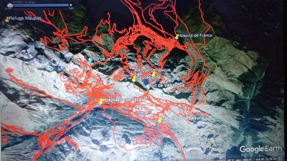
I am back to trying to understand the diverging opinions on the challenges of this hike, whichever her exact route. Otto, that last photo with the paths marked in red (and yellow for switchbacks) leaves me open mouthed. Just hard for me to believe someone would be doing this solo, late in the day, in November, when trails were essentially closed (so no one around)and temps dipping below zero at night, without a serious signalling/locating device?
I know there are different philosophies as to risk and that for some, the risk of the dangerous, solo, hike is part of the game, but this just leaves no room for error or accident. A slip, a twisted ankle, a bit of light-headedness at the end of a long day could easily result in a painful death for the hiker, desperation and anguish for the family, and risk of serious injury to members of the (obligatory) search team.
Perhaps Esther "ended it all" of her own volition, but I can't help but see the probability of a nightmare for everyone involved, including Esther. We can only hope she didn't suffer terribly for a long time.