Found Deceased OK - Caitlyn Rose Case, 33, Traveling from Louisiana to Colorado, vehicle abandoned in Fort Towson, 5 Aug 2022

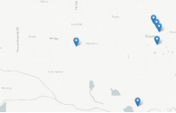
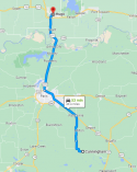
I made a Google My Map to help me visualize the data points provided by the family page. The Kiamichi river runs north of Hugo, OK, and feeds into Hugo Lake. I'm not sure exactly where Caitlyn's car was found in proximity to Kiamichi.

From what I've gathered from the family page, her last known location before the car was located is the ping to her phone which last pinged at the Kamaichi River location on August 5th at 11:56 pm.

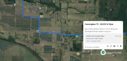
There is a time gap from her last pinged location in Cunningham, TX, departing at 6:59 pm on August 5th. Her car came to its final resting place on the same day at 11:56 pm. Even without knowing her exact location in Hugo, getting to the city of Hugo from her last known place in Cunningham is just a 56-minute drive. So she theoretically would have arrived in Hugo by 8ish. Her car was found at 11:56. Whatever happened in that nearly four-hour timespan in Hugo is critical.
1671522175704.png

I don't know if the family can provide details on those four hours in Hugo and where the car was found. CCTV may be of assistance here if we can determine where her car was found.
 
After she got off the phone with her father is when things may have turned. I wonder afterwards did she get lost again and didn't want to bother her dad. So maybe she stopped somewhere to get her bearings straight? I remember we were discussing this earlier in the thread now I don't remember what time dusk starts. But maybe that's when what happened to her happened. Her dad said that she was on the correct route afterwards. But it could be perhaps she was stressed and stopped driving for a short rest? As we discussed before we were speculating that she may have stopped at a friend's place. But this doesn't seem likely to me as her father was helping guide her back onto the proper route. So its unlikely she stopped at someone's she knew otherwise they would have helped her.
 
After she got off the phone with her father is when things may have turned. I wonder afterwards did she get lost again and didn't want to bother her dad. So maybe she stopped somewhere to get her bearings straight? I remember we were discussing this earlier in the thread now I don't remember what time dusk starts. But maybe that's when what happened to her happened. Her dad said that she was on the correct route afterwards. But it could be perhaps she was stressed and stopped driving for a short rest? As we discussed before we were speculating that she may have stopped at a friend's place. But this doesn't seem likely to me as her father was helping guide her back onto the proper route. So its unlikely she stopped at someone's she knew otherwise they would have helped her.
The sun officially set at 8:13pm CST that day. So when she left the Bogata/Cunningham area at 6:59pm is was likely dusk-like conditions. By the time she reached Hugo it would have been dark.

1671574695381.png
 
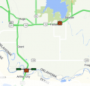
There are two sensor cameras near Hugo. The first captures people crossing the TX border and the second is on I-70 going east toward the Kiamichi River/Lake.

View attachment 388912


Beg pardon, that's Federal Highway 70, not Interstate 70. I-70 is significantly north of this location in Kansas.
 
I made a Google My Map to help me visualize the data points provided by the family page. The Kiamichi river runs north of Hugo, OK, and feeds into Hugo Lake. I'm not sure exactly where Caitlyn's car was found in proximity to Kiamichi.

From what I've gathered from the family page, her last known location before the car was located is the ping to her phone which last pinged at the Kamaichi River location on August 5th at 11:56 pm.

There is a time gap from her last pinged location in Cunningham, TX, departing at 6:59 pm on August 5th. Her car came to its final resting place on the same day at 11:56 pm. Even without knowing her exact location in Hugo, getting to the city of Hugo from her last known place in Cunningham is just a 56-minute drive. So she theoretically would have arrived in Hugo by 8ish. Her car was found at 11:56. Whatever happened in that nearly four-hour timespan in Hugo is critical.

View attachment 388827

I don't know if the family can provide details on those four hours in Hugo and where the car was found. CCTV may be of assistance here if we can determine where her car was found.
@Rayla Would you consider editing your post to show the vehicle traveling around the south side of Paris then northbound on FM79 then somehow it gets to the Kiamichi south of Ft Towson/north of Frogville (my guess would've been turned off US271 just north of the Red River and took OK-109 up to the Kiamichi)? This path is consistent with what OSBI released ADDITIONAL INFORMATION RELEASED IN SEARCH FOR MISSING LOUISIANA WOMAN from Oklahoma State Bureau of Investigation : Nixle , but what you posted isn't consistent with what OSBI said.
 
There are two sensor cameras near Hugo. The first captures people crossing the TX border and the second is on I-70 going east toward the Kiamichi River/Lake.

View attachment 388912


If most of us who drive that area were to go to the Kiamichi south of Ft Towson from TX, you'd take OK-109 (it's a shortcut if you're headed eastbound) and would bypass the camera at Fallon.
 
Just a reminder for those tracking her vehicle on Aug. 5. OSBI says she was no longer in the vehicle north of Bogata. Unfortunately, we don't know why they think that but hopefully it's an evidence-based conclusion?

I'm open to any possibilities but wanted to give that FYI.
 
Based on the helpful links and comments above, I have updated the Google My Maps information to more accurately reflect LEs statements. Apologies for the inaccuracies initially. I made it during an insomnia episode :)


I am very curious about the bolded below (BBM from this OSBI article)

At approximately 9:00 p.m. on August 5, 2022, Case’s vehicle traveled around the south loop of Highway 286 in Paris to FM 79 where it proceeded in a northwesterly direction from Paris. Shortly afterwards, the vehicle is believed to have traveled north in an unknown path headed to Oklahoma. After entering Oklahoma on Highway 271, the vehicle then turned east on Highway 109 south of Grant, Oklahoma.


She exited the south loop of Highway 286 in Paris onto FM 79 and "traveled north in an unknown path headed to Oklahoma." They confirm she entered Oklahoma on Highway 271 but how she got back to 271 appears to be a mystery. It could be that she realized her error and simply turned around on FM79 and got back to Highway 271. I don't see any place where FM79 meets up with Highway 271 (locals please correct me if I'm wrong). Whatever happened in that time frame is crucial. I wish we knew what time she crossed the TX/OK border.

Just a reminder for those tracking her vehicle on Aug. 5. OSBI says she was no longer in the vehicle north of Bogata. Unfortunately, we don't know why they think that but hopefully it's an evidence-based conclusion?

I'm open to any possibilities but wanted to give that FYI.
Correct @WingsOverTX here is OSBIs comment:

At this point in the investigation there is concern that someone other than Case was in control of the vehicle. It is believed that an attempt was made to deposit the vehicle in the Kiamichi River to hide its location during the late-night hours of August 5, 2022. It is not believed at this time that Case physically entered Oklahoma.
 

I created a GMM early on, so it does have some old info that has since been revised/considered unimportant.

Timeline built from the info on findcaitlyn website:

July 31 - flew to Houma, LA
Aug 4 - left Houma, LA
Aug 5, 5:00 pm - Call with father drops, five miles south of Bogota, TX
Aug 5, 6:10 pm - Wi-Fi hit on CR 17300, southeast of Cunningham, TX
Aug 5, 6:59 pm - vehicle leaves Cunningham, TX, per OSBI
Aug 5, 10:53 pm - 911 call, was not dispatched, no location given
Aug 5, 11:46 pm - car dumped/left on private property, two vehicles enter, only one leaves
Aug 13 - search of property done by non-profit group, but ended early at property owner's request

The details are good but confuse me further.

- How is it that voice calls were working but the data spotty/bad to be unable to navigate?
- the website talks about "Solar Plant area south of Cunningham, TX. FM17360/17300" but I cannot locate neither the solar plant nor FM 17360.
- Again, the distance from Bogota, TX to Fort Towson, OK is quite far. I cannot recall a case where the car was taken so far away.
- I find it particularly strange that they dumped the car but the cell phone was still inside, which was the only way that the family was able to trace where the car was found.
- it seems especially strange to have trespassed on private property to do so.
- It does confirm my earlier belief that there had to have been two cars, one left Caitlyn's car and then rode off with the other one.
- Unless my analysis of the river is wrong (see earlier in this thread), the current flow doesn't seem strong enough to carry away a car, and August is a low time for the river.
- I'm inclined to think that 'they' were familiar enough with Fort Towson area to take it there, but then confused at them trying to dump it at the river.

I don't have a really solid idea/grip on what may have happened.
Apologies, I missed your GMM. Thank you for the summary.

As someone who lives in Texas, I am not surprised by the spotty cell coverage in the more rural areas. When I travel through central Texas, I always bring an old-fashioned Mapsco or google maps printout because I often lose coverage once I get out of the big city.

The Cunningham area's nearest tower is north in Halesboro:

1671666806253.png

The Solar Farm is near where an eyewitness spoke to her in his driveway and told her she was going the wrong way.

1671667480742.png

It's hard to describe just how remote that area is. Google street views for that area haven't been updated since 2008, the most recent I found was in 2013. There are not a lot of non-locals traveling through those areas.

IMO whatever occurred happened between her last cell ping in Pattonville, TX on 8/5/22 at 7 pm and when a license plate reader captured her car exiting Highway 286 onto FM79 in Paris, TX heading North toward Oklahoma at 9:17 pm.

The drive from Pattonville to that exit in Paris is only 15 minutes. Her license plate should have been read there around 7:15 pm - 7:20 pm. It didn't register for 2 hours and 17 minutes. What happened during that time?

The drive from Paris, TX, to the OK border, where her car is seen, only takes about 20 minutes. They would have crossed the border by 9:40 pm. It only takes around 20 minutes to arrive at the Kiamichi River location, where her car was found south of Fort Towson. This was done quickly.

The private property information and the uncooperativeness of the owners also stump me. I really hope this case will be solved soon.
 
There are two sensor cameras near Hugo. The first captures people crossing the TX border and the second is on I-70 going east toward the Kiamichi River/Lake.

View attachment 388912

So, one would think that her vehicle would be picked up by that sensor camera going towards the Kiamichi River/Lake. There are a couple of things IMO to consider here. 1) If her vehicle was picked up on that camera what time was it picked up. Are our fears justified that it was after dark and if she stopped in a desolate area briefly someone took opportunity? 2) Was it someone disguised perhaps in a hoodie since most likely if the vehicle was spotted on the camera it was after she was guided on the correct route by her dad?
 

I created a GMM early on, so it does have some old info that has since been revised/considered unimportant.

Timeline built from the info on findcaitlyn website:

July 31 - flew to Houma, LA
Aug 4 - left Houma, LA
Aug 5, 5:00 pm - Call with father drops, five miles south of Bogota, TX
Aug 5, 6:10 pm - Wi-Fi hit on CR 17300, southeast of Cunningham, TX
Aug 5, 6:59 pm - vehicle leaves Cunningham, TX, per OSBI
Aug 5, 10:53 pm - 911 call, was not dispatched, no location given
Aug 5, 11:46 pm - car dumped/left on private property, two vehicles enter, only one leaves
Aug 13 - search of property done by non-profit group, but ended early at property owner's request

The details are good but confuse me further.

- How is it that voice calls were working but the data spotty/bad to be unable to navigate?
- the website talks about "Solar Plant area south of Cunningham, TX. FM17360/17300" but I cannot locate neither the solar plant nor FM 17360.
- Again, the distance from Bogota, TX to Fort Towson, OK is quite far. I cannot recall a case where the car was taken so far away.
- I find it particularly strange that they dumped the car but the cell phone was still inside, which was the only way that the family was able to trace where the car was found.
- it seems especially strange to have trespassed on private property to do so.
- It does confirm my earlier belief that there had to have been two cars, one left Caitlyn's car and then rode off with the other one.
- Unless my analysis of the river is wrong (see earlier in this thread), the current flow doesn't seem strong enough to carry away a car, and August is a low time for the river.
- I'm inclined to think that 'they' were familiar enough with Fort Towson area to take it there, but then confused at them trying to dump it at the river.

I don't have a really solid idea/grip on what may have happened.
Italisized part by me: How high was the river? Even if the currrent wasn't strong enough perhaps the perp/s thought that it will drift into the river if its left at the location it was? IDK just a thought of a possibility. So was her vehicle overtaken or hijacked by someone after 6:10PM?
 
Last edited:
New poster from the family with some interesting additional information:

1671738796031.png
"On August 17th, 2022 there was a sighting by two eye witnesses who believe they saw Caitlyn crying in the back seat of a disabled white SUV that had been pushed from the road by two white females into the CEFCO station located at 3750 Lamar Ave off of the Southeast 286 Loop in Paris, TX. The witnesses observed a dark colored SUV that came to assist the disabled vehicle".

The family has also started a Go Fund Me: HELP US FIND CAITLYN, organized by Peg Case
 
- the website talks about "Solar Plant area south of Cunningham, TX. FM17360/17300" but I cannot locate neither the solar plant nor FM 17360.
I've spoken with some of the family/friends and hopefully the website will be updated in a bit, but the FM17360/17300 reference is actually County Road 17360 and County Road 17300.

To see these roads, look at Cunningham TX then south and southeast (CR17300 comes due south out of Cunningham and loops around connecting back to FM 196 & CR17360 is a cutacross on the CR17300 loop).

If you look at a satelite view of Cunningham, TX, all of the rows of panels are visible south, west, north and some east of the town.
 
New poster from the family with some interesting additional information:

View attachment 389273
"On August 17th, 2022 there was a sighting by two eye witnesses who believe they saw Caitlyn crying in the back seat of a disabled white SUV that had been pushed from the road by two white females into the CEFCO station located at 3750 Lamar Ave off of the Southeast 286 Loop in Paris, TX. The witnesses observed a dark colored SUV that came to assist the disabled vehicle".

The family has also started a Go Fund Me: HELP US FIND CAITLYN, organized by Peg Case
I'm going to ask a direct question here because it has always been on my mind from the beginning. Does the family think something happened after 6:10PM or right after finishing the conversation with her dad? Does her family think she may have taken a rest after speaking to Dad and after a couple of hours something happened? If Caitlyn's trip was actually going be releatively short then one would think that she may not need a rest, however, the situation may have called for rest due to stress about the route and getting mixed up about the correct route in the first place? I know that would happen to a lot of folks even those who are well travelled.
 
I'm going to ask a direct question here because it has always been on my mind from the beginning. Does the family think something happened after 6:10PM or right after finishing the conversation with her dad? Does her family think she may have taken a rest after speaking to Dad and after a couple of hours something happened? If Caitlyn's trip was actually going be releatively short then one would think that she may not need a rest, however, the situation may have called for rest due to stress about the route and getting mixed up about the correct route in the first place? I know that would happen to a lot of folks even those who are well travelled.
That is possible. OSBI has only said she was no longer with the vehicle after Bogata.

I would like the family to clarify why she was likely on a path northwest & in Gainesville then soon after is directly east of there near Paris. What was her travel path on each day?

If she was truly "lost" on Aug. 5, I find that VERY ODD. I wonder what her planned route to Colorado was. I've driven from East Texas to CO several times both ways. Once she got to Gainesville, Wichita Falls would have been the natural next destination unless she was going to go north into OK or KS before turning West toward CO into the big empty out there.

Did she have some other planned stops that detoured her or was someone else in the vehicle (perp or not) when she headed east instead of continuing west or north?

Does LE and/or the family think she is a crime victim? If so, why? If not, why?

Still too many unknowns 5 months after this disappearance. What info is being withheld and WHY?

I also don't understand why there was a website launched in December. She's been missing long enough for this search to grow very cold. Is the family no longer trusting that OSBI can solve this?
JMO
 
Last edited:
That is possible. OSBI has only said she was no longer with the vehicle after Bogata.

I would like the family to clarify why she was likely on a path northwest & in Gainesville then soon after is directly east of there near Paris. What was her travel path on each day?

If she was truly "lost" on Aug. 5, I find that VERY ODD. I wonder what her planned route to Colorado was. I've driven from East Texas to CO several times both ways. Once she got to Gainesville, Wichita Falls would have been the natural next destination unless she was going to go north into OK or KS before turning West toward CO into the big empty out there.

Did she have some other planned stops that detoured her or was someone else in the vehicle (perp or not) when she headed east instead of continuing west or north?

Does LE and/or the family think she is a crime victim? If so, why? If not, why?

Still too many unknowns 5 months after this disappearance. What info is being withheld and WHY?

I also don't understand why there was a website launched in December. She's been missing long enough for this search to grow very cold. Is the family no longer trusting that OSBI can solve this?
JMO
I agree. Something is amiss.

MOO
 

Members online

Online statistics

Members online
65
Guests online
3,540
Total visitors
3,605

Forum statistics

Threads
592,113
Messages
17,963,426
Members
228,686
Latest member
Pabo1998
Back
Top