I am familiar with this hike and trail as I summited Iron Mountain (solo) via the Heaton Flat Trail in 2015. This is a very grueling and strenuous hike from 2,000 feet elevation to 7,000 feet elevation at the summit. It is known to be the most strenuous single day hike in all of the San Gabriel Mountains, and I can vouch for that. Below you will find some reflections I am having now (in 2022) of my 2015 hike of Iron Mountain which hopefully can be of some help to locating Maria.
I passed only 2 other parties of hikers the entire day, so the trail is not very traveled at all (well, in 2015 it wasn't). It is ill-advised to hike this during the summer as there is no water source and would require heavy water carry (probably 6-8 liters needed during summer). However, looks like she made a February attempt which would be more manageable with 2-3 liters.
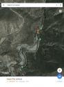
The hike is broken into two distinct sections:
1) Lower section - Gradual incline for several miles until finally reach a "plateau" (looks like a helicopter landing area)
2) Upper section - I believe it is 3 steep miles up to the summit, extremely steep and easy to fall and slip - but no "drop offs" or anything, at least from the main trail
There is no real way to get lost on the lower section of the hike, and there are no real dangerous spots. Yes, there are some side trails that lead down to some historic mines, but the main path is very direct, so one would not get lost on the lower part.
On the upper section, it is extremely steep and grueling. I do not recall any difficulty finding the trail on the way up. However, I recall being light-headed and tired from the grueling full-day ascent to the summit. Some portions of the upper section required scrambling across boulders on all-fours due to steepness, but none of this is dangerous, just time-intensive.
The summit of Iron Mountain is truly spectacular. You can not only see the city of LA, but you can see the pacific ocean and Catalina island, 60+ miles away. It is a remote and spectacular sight. You also have 360 degree views in all directions, from a spot that is literally in the middle of the San Gabriel Mountains.
At the summit, it becomes VERY easy to get turned around. In fact, I made a mistake when I left the summit as I traveled in a south westerly direction down a use-trail (which I thought was the main trail). Soon, I was traversing across a hill-side and the trail got super-steep. In fact, it was so steep that soil was sliding from below my shoes down what appeared to be a huge drop. I literally grabbed some bushes to maintain my balance and made my way back up. Had I not been exhausted, I probably would have realized much sooner that this was not the way I had climbed up. I finally made my way back to the summit and after a couple minutes found the main trail again.
I also recall reading a news article maybe 10 years back or so where 2 people were lost near the summit, and I believe one of them actually fell and ended up passing away. I can't find the article any longer, but will keep looking for it.
The area is super remote, but I would imagine she may have taken the wrong path down from the summit, like the mistake that I almost made. It is so easy to get turned around at the top being so exhausted. Hope she is found soon.