capitola51
Well-Known Member
- Joined
- Jun 26, 2021
- Messages
- 125
- Reaction score
- 822
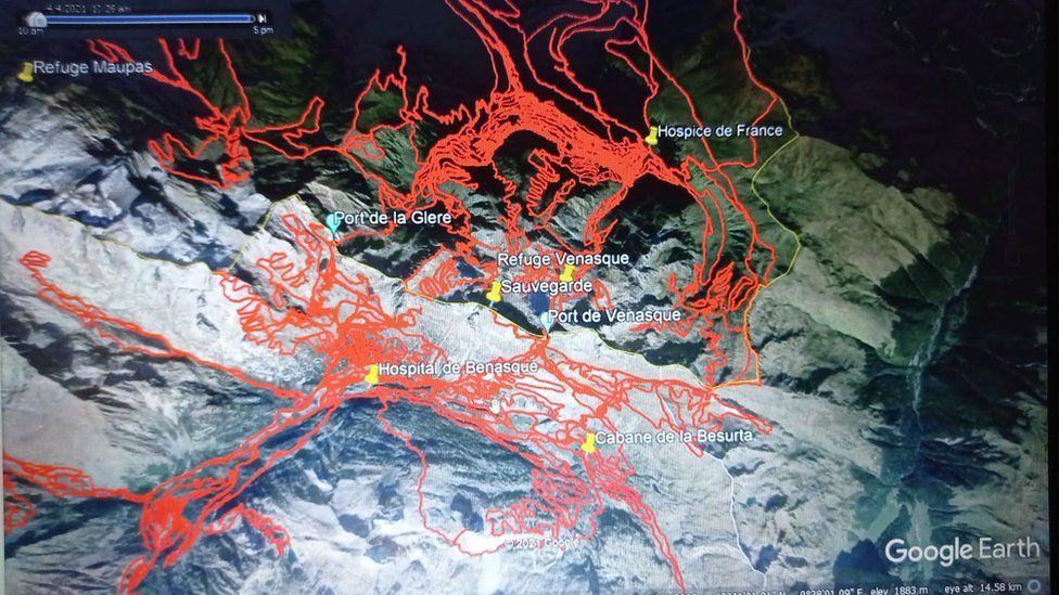
146 feet! Wow. I found this french language web site ( Boums de Venasque - Bagnères de Luchon ) here is a partial translation:Thanks @capitola51. What a beautiful day. And I loved the goats. All familiar images. We've studied this trek ad nauseam. And be careful interpreting the lake images. Two lakes are filmed.
The lake by the refuge is much more shallow and smaller than Boum de Vanesque under the backside of Pic de Sauvegarde. Boum de Vanesque is 46m or 151 feet deep. That is a mighty deep lake. If ED fell into the lake from the top of pic de sauvegarde or from the scree fields surrounding the lake, or committed suicide by walking or swimming into the lake and drowning, she could be lying in peace far below the visibility of a surface drone or from the edge of the lake.
Boums de Venasque - Bagnères de Luchon
“One of the high places of Pyrenean tourism since the beginning of the 19th century ... There were also many deaths during the long periods of snowfall, at the Trou des Chaudronniers of course (the "anecdote" is quite famous) but especially of falls in the Ravin du Culet. These dead were not tourists but people from the Spanish or French valleys who passed to trade through this port, one of the main places of passage between Aragon and France after Somport. The corpses were discovered when the snow melted, that is to say with the accumulations, in June or even July, at the height of the tourist season. ”
Anyway the site has some decent pics of the lakes.