Pumphouse363
Well-Known Member
- Joined
- Sep 17, 2021
- Messages
- 234
- Reaction score
- 974
It’s not possible to fully understand what happened here unless you actually know the people involved. I think you make some very good observations about them based on the information available. What baffles me is the fact that many people cannot understand why they would take Miju and Oski on this hike in this weather (your point number 4) but do not consider either Jon nor Ellen capable of equal aforethought and compassion for the most important person and beloved pet in their lives.I agree with you totally @MrsEmmaPeel
I am a bit older than JG but I burnt out around his age...I was trying to manage multiple businesses, properties, parents, grandparents, extremely unhelpful banks, children, husband, dog, clients, non-stop social media interaction, health problems plus many more different projects simultaneously over many years. The 24/7 stress was enormous.
Indeed Life can be far more complicated these days if we allow it to be. Much more is expected of us. A lot comes down to knowing yourself 100% and applying 'boundaries'.
I'm convinced that perfectionists (knowing that I am a recovering one myself) have a huge time not giving in. It seems like an admission of defeat. It's really hard to turn around and retrace your steps especially if something is not working.
In the end my stressful life blew up. I was juggling too many balls. Luckily there were no casualties involved, thank goodness. I have learned a lot of lessons the hard way. I try to be much more relaxed as a consequence. Giving myself time and pausing to reflect on decisions helps massively.
This case has really intrigued me. It contains many elements afflicting all of our lives. Not least that of climate change.
I was also intrigued by what @ItalyReader was saying about their SF lifestyle. I too moved away deliberately from a City of London lifestyle a long time ago but I did not manage to shake the perfectionist tendencies until I was absolutely forced to. Hey ho.
My take on this:
1. They had moved to the area to live a particular lifestyle and they had to evidence that they were doing this to prove that it was working.
2. The loop was researched so it had to be done come what may.
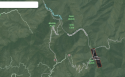
3. It could be that they were trying to gain elevation to get a phone signal to get help combinec with getting back to the car. Staying down at the river seems/seemed counter intuitive (to them) - this reminds me a little bit of the Geraldine Largay case.
4. I cannot fathom bringing the baby and dog (those absolute darlings) but I believe that they were a big part of their new lifestyle. In fairness, that fateful day was a family outing to spend quality time together...
5. I agree again with @MrsEmmaPeel that involving a baby in your life is a huge, huge adjustment.
I sympathise and empathise with their families and friends enormously. I am sure that the family are hugely missed. May they rest in eternal peace.
Thank you to @Pumphouse363 who has been able to provide us with further information where info has been pretty scarce.
I have also read everyone's comments on these threads and learned a heck of a lot in the process. I'm still a Newbie here and am amazed at how much expertise and knowledge everyone has! I'm aiming to put a lot of this new-found valuable information into practice as soon as I can.
Really impressed with how your LE has handled the case too...really sensitively. It's nice to know that that can still happen in these weird times.
All of this JMO.
I will never believe they did this and I don’t believe there is sufficient evidence to prove they did. MOO