WingsOverTX
Former Member
- Joined
- Mar 19, 2022
- Messages
- 2,974
- Reaction score
- 25,963
I echo that! Hoping the best for you!My thoughts are with you @PayrollNerd .
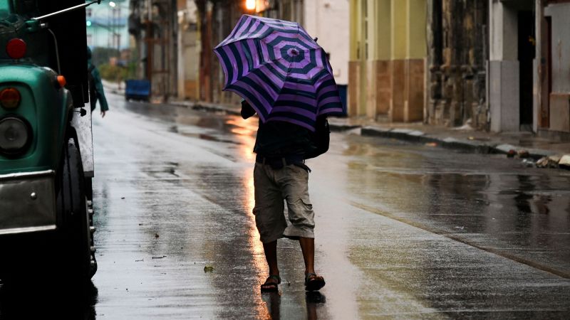
Stay safe!

Follow along with the video below to see how to install our site as a web app on your home screen.
Note: This feature may not be available in some browsers.
I echo that! Hoping the best for you!My thoughts are with you @PayrollNerd .
Stay safe!
Hope it gets downgraded. A Category 4 would be several extra degrees of terrible. My thoughts are with all in Ian's path.It is coming in bigger, faster and meaner as the hours tick by. Hang on tight SWFL!!
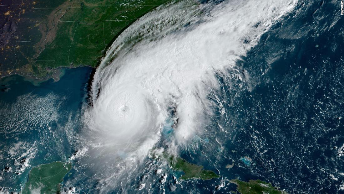
Hurricane Ian knocked out power to all of Cuba and is now heading toward Florida where officials urge evacuations | CNN
More than 2.5 million Floridians were under some kind of evacuation warning Tuesday as Hurricane Ian marched closer to the state's west coast after knocking out power across all of Cuba.www.cnn.com
Ian will likely make landfall Wednesday afternoon to evening between Sarasota and Port Charlotte as a Category 3 or Category 4 hurricane. (Hurricanes are designated as Category 4 when winds reach speeds of 130 mph to 156 mph.) Whichever of the two it is, one forecaster warned the storm still be a “large and destructive hurricane” for the state, urging residents to listen to local leaders’ advice.


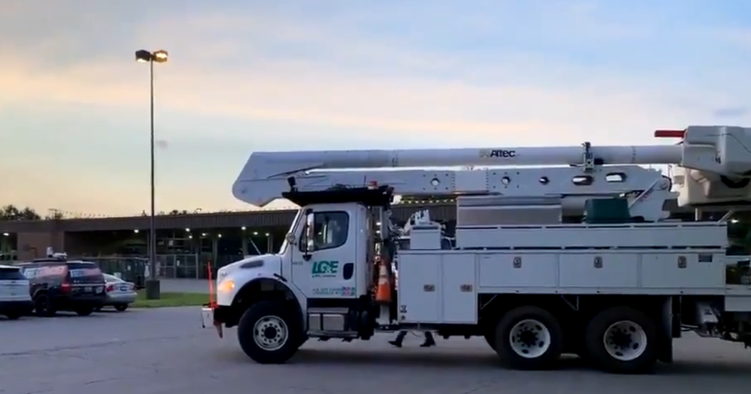
Oh bless you and all the other drivers, for ensuring the rest of us have access to stores and gasoline. That sounds like a hard job in really bad weather. But, I'm sure you all are experienced pros and will get the job done well!! Thank you!We loaded 5 generators today (on our personal rig) that are big enough to power a store (each). They are going to gas stations for tomorrow (Wednesday) to be put into place for when they lose power, they can still operate the stores and pump gas if gas is available. Think HUGE generators. We loaded 5 flat beds (from our company), 5 generator's each today and were not the only company grabbing these and driving overnight with them.
We are rolling as a convoy overnight to get these there. On the normal we deliver steel and heavy equipment, but when emergencies happen we are on call. One key thing we have learned is to stop and take a hour or two and shower, and grab truck supplies so we can sustain ourselves for a few days if we get placed into a holding pattern, During Katrina, we were on a tarmac for 4 days without any assistance of any kind, it was then when we learned to stop and stock a truck for our own needs while supplying the needs of others.Oh bless you and all the other drivers, for ensuring the rest of us have access to stores and gasoline. That sounds like a hard job in really bad weather. But, I'm sure you all are experienced pros and will get the job done well!! Thank you!
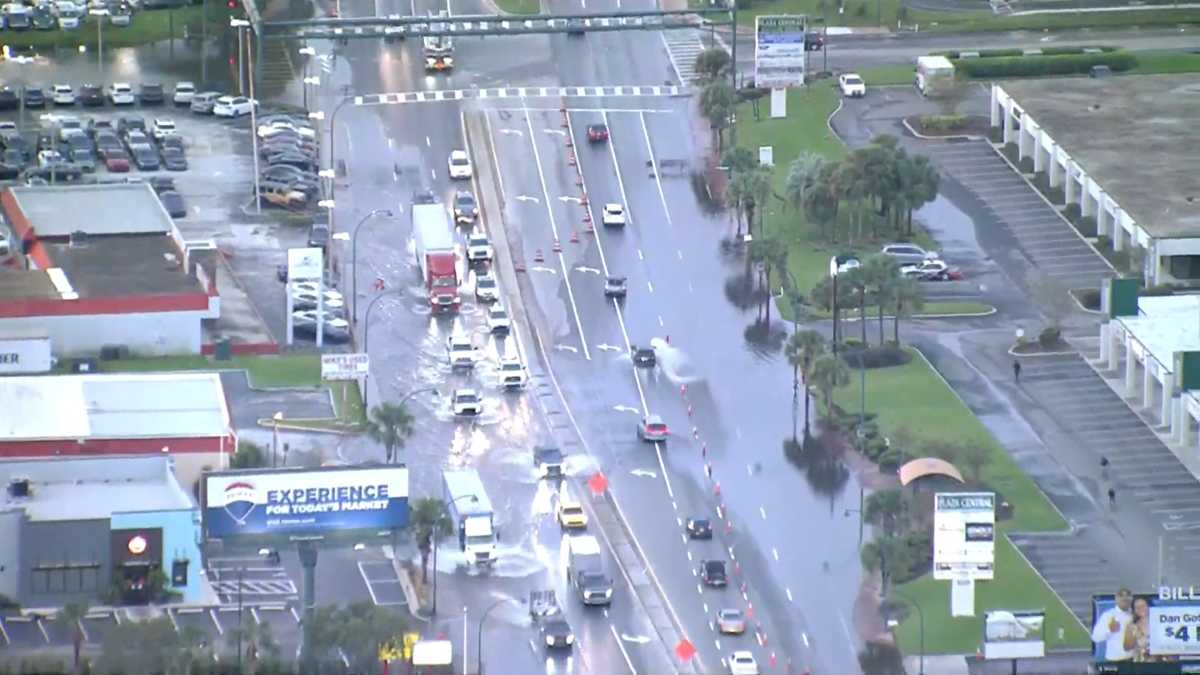
I lived in St Petersburg at the time of Hurricane Charley. I was job hunting and totally unaware of a hurricane until one of the places I visited. Then as it began to get dark that same day, a vehicle drove around announcing on a loud speaker that we were to evacuate. I called my brother who lived outside of Orlando closer to the airport, Ventura Country Club, a gated community. He insisted I drive there as no hurricane in that area. I am directionally challenged and of course got hopelessly lost in pitch black darkness with eerieness of a hurricane looming.This storm is eerily similar to Hurricane Charley from 2004. I live in Clearwater now but I lived in Tampa then. It was supposed to be a direct hit on Tampa Bay and ended up making landfall in Punta Gorda. Charley also came off of western Cuba and made the turn more toward the east. I am not letting my guard down here in Pinellas County yet though.
Howdy neighbor! I just opened the doors in front and back to peek out as the sun is coming up. Intermittent strong winds blowing rain in every direction. Some whistling wind. Trees are swaying. A piece of my gutter at the bottom came off. I’ll have to go stick it back on then sit a piece of concrete on it. Stay safe!I'm also in Sarasota county. Winds now picking up. Told the dogs it's last call for outside potty. Got to transition to indoor area. Still have power, but reports are that many don't. They even put up a graphic and said 100% power loss anticipated here. We have a generator, so should be ok.
Payrollnerd I'm south of University Pkwy & Tuttle.
 www.wesh.com