Maps & Aerial Photos *** NO DISCUSSION ***

I credit Truthspider with the next series of photos that target an area of concern that he pointed out to us a few months ago. This is what the area looks like on Google that sparked his interest;

TruthspidersareasofinterestviaGoogle.png


Here is the same area taken March 2011;
TruthspidersareasofinterestfromSouthMarch11.png


Here it is again viewed from the South in March zoomed in more;
Truthspidersareasofinterestzoom1March11.png


This is what it looked like viewed from the same angle back in April 2006;
TruthspidersareasofinterestfromSouthApril2006.png


As you can see, there is some significant noticeable changes in the terrain. I have my theories on what we are looking at and I can tell you that I am pretty certain that they are man made.

More before/after photos from different angles about to be posted...
 
Truthspider's area of concern viewed from the North in 2006;
TruthspidersareasofinterestfromNorthApril2006.png


Same area viewed from the North in 2011;
TruthspidersareasofinterestfromNorthMarch2011.png
 
Truthspider's area of concern viewed from the East in 2006;
TruthspidersareasofinterestfromEastApril2006.png


Same area viewed from the East in 2011;
TruthspidersareasofinterestfromEastMarch2011.png
 
Truthspider's area of concern viewed from the West in 2006;
TruthspidersareasofinterestfromWestApril2006.png


Same area viewed from the West in 2011;
TruthspidersareasofinterestfromWestMarch2011.png
 
Excellent work! Thanks for your dedication.

Is this on Google Earth/Google Maps?
 
This is a view of the wetlands and Anchor Way looking from the West back in April 2006;
AnchorswayfromWestApril2006.png


Now if you look at the same area viewed March 2011, we see that someone has been doing some serious trailblazing;
AnchorswayfromWestMarch2011.png


I know LE did some searching of the area. I suppose it is possible that this is their work (yet so far after scanning photos of the rest of Jones Island where the searches took place too I have not come across such drastic changes in the landscape when comparing the 2006 photos to the 2011 photos).

Anyone know when those searches were conducted and if they even did any trailblazing like this within this area?

This is a close-up view taken March 2011 from the North of the new trail;
newtrailfromNorthMarch2011.png


Here is what the area looked like from the East back in April 2006;
newtrailfromEastApril2006.png


This is the same photo taken March 2011;
NewtrailsviewedfrmEast.png


Here is a closer look from the East in March 2011;
newtrailfromEastMarch2011.png


This area is easily accessed via foot. The trail that was blazed off of Anchor Way probably is part of some sort of approved project. It's the new trail near the tool shed that bothers me. You can tell in the old photos that it was once a foot trail but in the new photos it is clearly widened enough that a small pickup could drive into the brush.

Both the access to the tool shed/tennis court road as well as the new trail off of Anchor Way would have been clearly visible from the camera at the Guard booth that is pointed towards the vehicles that are leaving the community.

Is it possible that the tapes were lost/erased to prevent the viewing of someone entering one of these two areas off of Anchor Way?
 
Thanks for your fine work on these photo comparisons.

So, is the assumption that the spring flooding unearthed a body from a shallow grave in this area?

And is the scuttlebutt that it is Shannan?
 
I really appreciate your work here too Seaslug. This article from today might be posted somewhere but haven't seen it:

http://www.longislandpress.com/2011/12/06/long-island-serial-killer-update-search-to-continue-wednesday/

Long Island Serial Killer Update: Search to Continue Wednesday
By Jaclyn Gallucci on December 6th, 2011

"An SCPD vehicle blocks a roadway in the Oak Beach community Dec. 6, 2011. (Rashed Mian/Long Island Press)

Suffolk County police denied reports that more human remains were found in Tuesday’s search of the marshland adjacent to the Oak Beach community where Shannan Gilbert disappeared in 2010, during a news conference Tuesday afternoon. They would not comment on what evidence was collected, but did not deny reports that clothing and other items, possibly belonging to Gilbert, were found at the scene.

“We did not find any human remains today,” said Inspector Stuart Cameron of the Suffolk County K-9 unit, but added that the search for Shannan Gilbert, which began at 8 a.m. this morning, would continue tonight and resume Wednesday morning.

Cameron said the marshland that borders Anchor Way in Oak Beach, the road where Gilbert was last seen running, had been searched before but that the land sinks, making it difficult to walk through.

“You sink in sometimes up to your knees,” said Cameron."


I can't find that tennis court on the Google map showing 35 or 33 Anchor Way. But I think that open area that flooded is to the right or East of
Anchor Way, correct?

This could be so big if they did indeed find some of Shannon's things in that particular area. In this article it says LE believe she is close to Oak Beach and buried there. "Police Commissioner Richard Dormer said . . . Snip. . . that Gilbert is believed to be dead and her body located in the Oak Beach area".

Makes my heart jump to think of it.
 
In old 2006 aerial photos I discovered a 4x4 dirt access road along side where Jessica Taylor's skull, hands & forearms were discovered on March 29th in Gilgo State Park. And when I look at the updated photo of the area (taken 4/4/11) that dirt access road no longer exists!!

I wonder if the police investigators are aware. It had always been speculated that perhaps the SK threw her remains into the brush from Ocean Parkway (because the brush was so thick going in from Ocean Parkway).

But what if he simply drove up the access road?

He stood little chance of being caught when he got out of his car because I doubt the dirt road was used very much.

Better yet, at the other end of this road is access to a beach with deep water right up to the shoreline. What if our serial killer accessed the area from boat in the middle of the night and walked her remains up to the highway end of the access road to make it look like her remains were thrown from a vehicle?

This is one of many photos taken 4/4/11 of where Jessica Taylor's remains were found;
JessicaTaylorbodypartsphototakenApril42011.jpg


Here is another;
JessicataylortakenApril42011.png


Now this is sooooo creepy...

Here is a view of the exact same area from March 2006. I used triangulation between the center of two trees to measure exactly where Jessica Taylor's remains were found and I placed an X at that location in this photo. You can clearly see the dirt access road for four wheelers just to the East of where her remains were found. If you look at the photo above, this road is completely hidden under the brush now.

Here is the photo-
JessicaTaylorremainsnear4x4road2ndphotoMarch2006.png


Here is another view of the entire road;
4x4Accessroad3rdphototalenMarch282006.png


What bothers me is that if the investigators did not know that this road existed, they may not have tried searching the land to the East and West along side where the road stood all the way North to where the road ends at the bay. I am seriously getting the creeps. That area at the very end of the road is so far from any homes or roads that it is very possibly that area could have been our SK's early kill site. A victim could scream at the top of her lungs for hours with no chance of anyone hearing her/him. The SK and any victims he brought there would have been completely isolated from the rest of the world and could have butchered bodies right there on that bay coast line without any chance of being discovered! It was determined that Jessica Taylor was not killed at the location in Manorville where her torso was placed out in the open. Ever since the rest of her remains were found at Gilgo it has been assumed that she was killed in a third location separate from Manorville and Gilgo.

This is a photo of the end of that road with an isolated hard sandy area over 600 feet long and 100 feet wide. It could easily had been his early kill site and law enforcement needs to be notified to search it;
endofroadpossiblekillsite.png


Here is another image of the forgotten 4x4 access road from end to end. Notice the beach access to the bottom right where the water is deep enough for even a larger boat to pull bow first right into the beach!
4x4Accessroad2ndphototalenMarch282006.png


And here is one more closeup of the entrance with an arrow pointing to where the search discovered some of Jessica Taylor's remains;
JessicaTaylorremainsnear4x4roadMarch2006.png


UPDATE: I just submitted this info to Suffolk Crime Stoppers. Just need to wait for them to sift through the 1,200 under tips so they can get to this one.
 
I am exhausted so more to come another night. I had every intention of scanning the entire area where they are conducting the current searches but then I discovered the secret dirt access road at Gilgo while I was looking to see if the investigators trail blazed anything as remotely as intense as what I discovered in the Oak Beach photos (which they did not). After finding that discovery near Jessica's site I am now lured in to go and look for anything similar near the GB4 sites as well as where the other five victims were discovered. That's going to have to be another night. In the meantime, here are two last photos from that marsh area within Oak Beach Association;

The first is a four foot wide drainage ditch that runs all the way up to the road at Anchor Way. I could not tell in the previous photos but in this one I can easily see that one of the new trails that were blazed through the marsh since 2006 actually runs parallel to the drainage ditch. Makes me wonder if this was recently deepened within the past few years to absorb more of the runoff from the streets (I do not think Oak Beach Association has any sewer drains since the water table is so high).
4ftwidedrainageditchoffofAnchorWay.png


The second photo I dedicate to Truthspider and his relentless determination to send the owner of this home to jail. I have to give you some credit TS, you are relentless, brave and unstoppable (I am being serious... not mocking you in any way). If more Americans got off of their asses and stood up for what they believe in (the way you have been), our country would be a much better place. I don't have to agree with your theory to believe in what you are doing (and I do believe that your heart is in the right place).
CPHHouse.png


Good night everyone.
 
Seaslug, you are amazing. I need to re-read all of your posts here tomorrow and study your photos. My fingers are shaking as I type. I have this feeling LE knows what happened and the perp involved. I think they feel there is an excellent possibility of finding her remains or they wouldn't have said so much in that article.

Just sayin'
 
The second photo I dedicate to Truthspider and his relentless determination to send the owner of this home to jail. I have to give you some credit TS, you are relentless, brave and unstoppable (I am being serious... not mocking you in any way). If more Americans got off of their asses and stood up for what they believe in (the way you have been), our country would be a much better place. I don't have to agree with your theory to believe in what you are doing (and I do believe that your heart is in the right place).
Good night everyone.

Hitting the thanks button just wouldn't cut it for this. THANK YOU.

I have been thinking about technology a lot lately, specifically how technology is a race, but one that can't be won for it is always in equilibrium. Just as people will find way's to use technology to advance their crimes, others (that's us) will use it to stop them.

Today we have "burn phones" and the anonymity of the internet, but the same technical advances bring us high-res images, collation of data from the web, crowd-sourcing, and the collaboration of analysts from around the world. If we have indeed found her, it's a direct result of the synergy of this community.

Good morning everyone.
 
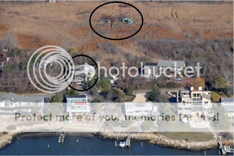
The circled area at the top is the police searching. The circled home belongs to CPH.
searchbehindCPHhouse.png


This is what that area looks like zoomed in from the sky from the South;
searchareafromSouth.png


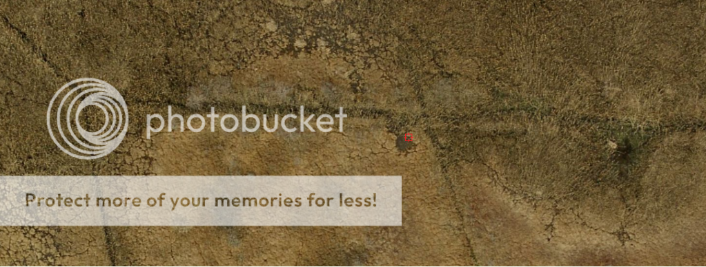
And this is what that area looks like when viewed from overhead. The canal that comes from the top left at an angle is the one that originates at Anchor way along the new trail that was cut. As you can see, that canal forks. The horizontal fork cuts right across the marsh towards Truthspider's area of interest (see posts above). The vertical fork of the canal runs almost up to CPH's rear yard. I will try to post more on that in a minute.
searchareafromabove.png
 
Wow, great sleuthing. Am I reading you correctly...do you think there are more bodies out there in the marsh? It actually makes sense.
 
Wow, great sleuthing. Am I reading you correctly...do you think there are more bodies out there in the marsh? It actually makes sense.

I don't think there are any bodies in the Oak Beach marsh (including SG). What I do think is that they should go back and search the area North of where they found Jessica Taylor's remains at Gilgo because there clearly existed a dirt road (that is now hidden under the brush). As far as I know, none of the searches went that far North (up to the end of the dirt road where it meets an open area with boat access).
 
More photos of the search. Tire tracks confirm that they have now searched right up to the rear door of CPH's house. Tire tracks also confirm that they have now searched Truthspider's point of interest too.
image.JPG


image.JPG


Tire tracks also confirm that they have now searched Truthspider's point of interest too.
image.JPG


This photo gives me the creeps because this is the same sort of excavator that you can find at a local cemetery preparing plots for upcoming funerals. Why the heck were they digging in this one area?
image.JPG


image.JPG


image.JPG


image.JPG


image.JPG

Hi Seaslug,
Thank you for these photos and info. It's mind-blowing that the "authorities" (for lack of a better word) are attempting to deceive the public again and again...do you still think there are no other remains in there? I'm not sure - I hope there isn't, but WHY are LE crawling all over that area now? Are they investigating trails??? This wouldn't be the first time that I've missed something...did I? Tx!
 

Members online

Online statistics

Members online
103
Guests online
2,991
Total visitors
3,094

Forum statistics

Threads
592,117
Messages
17,963,498
Members
228,687
Latest member
Pabo1998
Back
Top