2020 Hurricane Season Starting Early, "High Activity" Expected This Year

Yikes! I hope the people on the coast moved inland. I wonder where this monster is going next. Is there enough land mass and high enough mountainous terrain to bust up a Cat 4?

Hurricane Eta rapidly intensities into major storm, will be Category 4 by landfall

From the National Hurricane Center:
Key Messages: (BBM--sounds terrible! Prayers for those who will be affected.)

1. Catastrophic wind damage is expected where Eta's eyewall moves onshore along the northeastern coast of Nicaragua tonight or early Tuesday. Tropical storm force winds are beginning to reach the coast within the Hurricane Warning area in Nicaragua, and residents there should have completed their preparations. A Tropical Storm Warning is also in effect for the northeastern coast of Honduras.

2. A catastrophic and life-threatening storm surge, along with destructive waves, are expected along portions of the northeastern coast of Nicaragua near and to the north of where the center makes landfall. Water levels could reach as high as 12 to 18 feet above normal tide levels in some parts of the hurricane warning area. Preparations to protect life and property should now be complete.

3. Through Friday evening, heavy rainfall from Eta will likely lead to catastrophic, life-threatening flash flooding and river flooding across portions of Central America, along with landslides in areas of higher terrain. Flash and river flooding is also possible across Jamaica, southeast Mexico, El Salvador, southern Haiti, and the Cayman Islands.

205343.png
 
...ETA CONTINUES TO RAPIDLY INTENSIFY AS IT APPROACHES THE COAST OF NORTHEASTERN NICARAGUA... ...LIFE-THREATENING STORM SURGE, CATASTROPHIC WINDS, FLASH FLOODING, AND LANDSLIDES EXPECTED ACROSS PORTIONS OF CENTRAL AMERICA...
7:00 PM EST Mon Nov 2
Location: 14.4°N 82.4°W
Moving: WSW at 9 mph
Min pressure: 934 mb
Max sustained: 150 mph

National Hurricane Center
 
Pressure continues to drop...

...AIR FORCE RESERVE HURRICANE HUNTERS FIND THAT ETA HAS CONTINUED TO RAPIDLY STRENGTHEN AS IT APPROACHES NORTHEASTERN NICARAGUA... ...LIFE-THREATENING STORM SURGE, CATASTROPHIC WINDS, FLASH FLOODING, AND LANDSLIDES EXPECTED ACROSS PORTIONS OF CENTRAL AMERICA...
10:00 PM EST Mon Nov 2
Location: 14.1°N 82.7°W
Moving: WSW at 7 mph
Min pressure: 927 mb
Max sustained: 150 mph
 
Tropical Tidbits

Hurricane #Eta remains just offshore of Nicaragua this morning. Eta is undergoing an eyewall replacement cycle, leading to a broadening of the wind field and a slight decrease in max winds, though they remain at ~130-145 mph. Life-threatening flooding and winds are expected today
 
Likely just a rain event for us in SWFL. Those poor people in Nicaragua won't have any land left much less their homes. I can't imagine the devastation to such an underdeveloped countries.

South Florida is now in the cone of Hurricane Eta

The National Hurricane Center issued an update on Hurricane Eta that now puts Florida in the cone of uncertainty.

The hurricane center’s Tuesday afternoon update has the storm potentially reaching South Florida as a tropical storm on Sunday.

Eta made landfall in Nicaragua as a Category 4 storm and was traveling west, away from Florida, at 5 mph with sustained winds of 140 mph, according to the hurricane center.

It is expected to continue through Honduras before traveling up the coast of Belize and then cutting northeast across Cuba to South Florida. The storm could then travel up the state to Tampa Bay.
 
Well it looks like my aunt and uncle on the east coast and us on the west coast will get lots of rain and wind. My daughters two field days (Mon-Tue) are postponed.

Flhurricane.com

Tropical Storm watches are now up for the coast of South Florida from Sebastian Inlet southward (it was moved up further east from Jupiter overnight) on the east coast and from Bonita Beach southward on the west coast, including Lake Okeechobee. Also included in this watch are the Florida Keys.

Some of the watches may be upgraded to Tropical Storm Warnings later today.

There remains a very small chance that it regains hurricane strength, but is more likely to become a subtropical storm as time goes on. As of this morning Eta is still a depression, this is forecast to become a Tropical Storm again later today and looks better than it did yesterday already.

Tropical Storm Warnings are up for the Cayman Islands, Parts of Cuba, and the Northwestern Bahamas.

Key Messages:

1. Heavy rainfall is diminishing across portions of Central America,
although the threat of life-threatening flooding may continue, along with landslides in areas of higher terrain. Heavy rainfall from Eta will continue across the Cayman Islands and portions of Cuba,
resulting in significant, life-threatening flash flooding and river flooding in Cuba. Flash and urban flooding will also be possible for the Cayman Islands, Jamaica, the Bahamas and southern Florida.

2. Tropical storm conditions are expected later today and Sunday in portions of the Cayman Islands, Cuba, and the northwestern Bahamas, where a Tropical Storm Warning is in effect.

3. Tropical storm conditions are possible in the Florida Keys and portions of south and central Florida beginning late Sunday, where a Tropical Storm Watch is in effect. Tropical Storm Warnings could be required for these areas later today.

It's good that Eta is not likely to regain hurricane strength. I hope you Floridians won't be affected too badly by the storm.
 
Likely just a rain event for us in SWFL. Those poor people in Nicaragua won't have any land left much less their homes. I can't imagine the devastation to such an underdeveloped countries.

South Florida is now in the cone of Hurricane Eta

The National Hurricane Center issued an update on Hurricane Eta that now puts Florida in the cone of uncertainty.

The hurricane center’s Tuesday afternoon update has the storm potentially reaching South Florida as a tropical storm on Sunday.

Eta made landfall in Nicaragua as a Category 4 storm and was traveling west, away from Florida, at 5 mph with sustained winds of 140 mph, according to the hurricane center.

It is expected to continue through Honduras before traveling up the coast of Belize and then cutting northeast across Cuba to South Florida. The storm could then travel up the state to Tampa Bay.


Been trying to keep an eye on Hurricane Eta - it's been such a busy week for me and unfortunately my Saturday has been consumed with going over some software documentation for work, and an oil and filter change for my car. And I need my exhaust pipes replaced. 2005 Nissan Altima.

Plus it's starting to rain outside now...
 
In Mexico: "Tropical Storm Eta" news:
Heavy rains leave 21 dead in 3 states; thousands of homes damaged

"At least 21 people have died in Mexico’s south and southeast due to heavy rain that triggered landslides and continued to cause flooding as of Saturday morning.
More than 100,000 people in Tabasco, Chiapas and Veracruz have been affected by the rains brought by two cold fronts and Tropical Storm Eta . . .

The National Meteorological Service forecasts torrential rain in Tabasco, Chiapas and Quintana Roo due to Tropical Storm Eta, which was about 70 kilometers west-northwest of Grand Cayman at 9:00 a.m. CST.
Intense rain is also forecast for Campeche, Oaxaca, Yucatán and the south of Veracruz."
 
It looks like Hurricane Season will continue, unfortunately, with with two areas to watch at the moment in addition to T.S. Eta.

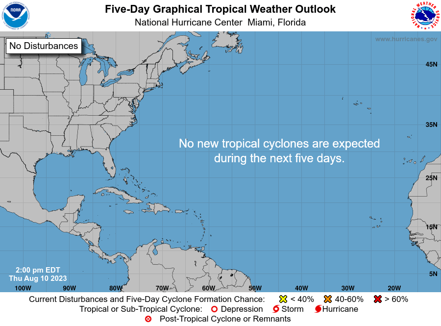
Atlantic 5-Day Graphical Tropical Weather Outlook

two_atl_5d0.png


Tropical Weather Outlook
NWS National Hurricane Center Miami FL
100 PM EST Mon Nov 9 2020

For the North Atlantic...Caribbean Sea and the Gulf of Mexico:

The National Hurricane Center is issuing advisories on Tropical Storm Eta, located over the southeastern Gulf of Mexico.

1. Shower and thunderstorm activity associated with a low pressure system located several hundred miles southwest of the Azores has increased and become better organized during the past several hours.

Satellite-derived wind data earlier this morning suggested that the system had not yet become distinct from a frontal boundary in the area, however, it will likely become non-frontal soon. The satellite data also indicated that the system is already producing gale-force winds. Additional development is expected, and a tropical or subtropical storm will likely form during the next day or two while the system moves eastward or east-northeastward over the northeastern Atlantic Ocean.
* Formation chance through 48 hours...high...70 percent.
* Formation chance through 5 days...high...80 percent.

2. A tropical wave is forecast to move over the central Caribbean Sea, where an area of low pressure could form in a couple of days. Environmental conditions are forecast to be conducive for development, and a tropical depression could form late this week or over the weekend while the system moves slowly westward.
* Formation chance through 48 hours...low...near 0 percent.
* Formation chance through 5 days...medium...50 percent.
 

Members online

Online statistics

Members online
76
Guests online
3,084
Total visitors
3,160

Forum statistics

Threads
592,284
Messages
17,966,633
Members
228,735
Latest member
dil2288
Back
Top