AK AK - Steve Keel, 61, missing from hunting trip, from TN - Aug 27, 2022

Status
Not open for further replies.
Remote Alaska is a dangerous place.

Probable victims of bad weather:
"Shane McIntyre, Carl Flynn and Justin Crow left Bethel in a KingFisher Extreme Shallow boat on the afternoon of Aug. 30 to deliver supplies for a moose hunt at a cabin up the Kuskokwim River, said Perry Barr, vice president of Bethel Search and Rescue. The men were expected to return home that evening."

Land AND water search:
Daniel Laraux, who goes by the name “One One,” went missing a week ago on the evening of Sept. 1, the day moose hunting opened in the Kuskokwim River area. Laraux and his partner had set up camp at Hoffman’s cabin. Hoffman said that the camp is about 5 miles upriver from Kalskag on the Old River Slough. Hoffman said that Laruax could have gone missing on land or water.

Doesn't sound good :(
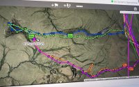
I put the cases up because I felt they gave a good idea of how a typical search goes in AK. There are definitely issues with terrain, in all 3 cases. In the 3rd case, search had to be conducted by ATV's: these were brought by volunteers, and they were coordinated from an SAR base camp. Note, however, though on the Dalton Hwy, this case is not as remote as the SK case. It seems similar to SK's, though, in that the missing hunter disappeared within short range of the hunting camp. He also didn't have anything on him that would facilitate survival, e.g. a pack and contents. Very sad.

The moose hunters went missing after SK. IMO it is ominous that the weather became that terrible on August 30th.
 
1/4 mile is a very short distance. At a normal walking pace that’s a 5 minute walk. Alaskan tundra or just about anywhere else in the world, cold weather, wet weather, or otherwise, it’s just not a big deal to walk that far and come back during daylight in a very short time. His hunting partner not going to look for him after a couple hours is puzzling. The information we have is either incorrect or incomplete, because the story so far just doesn’t add up. I read nothing about dense fog at ground level when he went. I know I know, Alaska isn’t Tennessee. But still, all the pictures I’ve seen you could see for miles in any direction, and he reportedly had a compass. How could he get so far off track that he couldn’t get back to the haul road and found by using his compass? If he became injured, he shouldn’t be that far from camp.
 
The searchers have shared some awesome Aurora Borealis images on the Search for Steve page. I don't feel comfortable copying & sharing them here since I don't have permission from the photographers so apologies to anyone who can't access the Facebook page.

 
1/4 mile is a very short distance. At a normal walking pace that’s a 5 minute walk. Alaskan tundra or just about anywhere else in the world, cold weather, wet weather, or otherwise, it’s just not a big deal to walk that far and come back during daylight in a very short time. His hunting partner not going to look for him after a couple hours is puzzling. The information we have is either incorrect or incomplete, because the story so far just doesn’t add up. I read nothing about dense fog at ground level when he went. I know I know, Alaska isn’t Tennessee. But still, all the pictures I’ve seen you could see for miles in any direction, and he reportedly had a compass. How could he get so far off track that he couldn’t get back to the haul road and found by using his compass? If he became injured, he shouldn’t be that far from camp.
"We can’t be 100% sure but we do know that Steve was using the compass on his phone but there’s true north and magnetic north. In the area they’re in you go by magnetic north. Since Steve was using his phone the phone didn’t calibrate for magnetic north so it was 17 degrees off. We don’t know if that played a factor in this situation but it’s a very good possibility"

COMMENT SHARED HERE:

BBM
 
I've been looking at the map link I posted earlier and found something weird. According to the photo of the map posted in the group, the new searchers are searching off of milepost 349 and all we've heard is the camp was at milepost 336.5. I've uploaded images of each below

Group post is the first image

Image with milepost came from here
 

Attachments

  • 305311884_587395999828523_6321254557429281378_n copy.jpg
    305311884_587395999828523_6321254557429281378_n copy.jpg
    149.3 KB · Views: 28
  • Screen Shot 2022-09-09 at 12.39.15 AM.jpg
    Screen Shot 2022-09-09 at 12.39.15 AM.jpg
    84 KB · Views: 28
went on a camping trip to AK years ago. they made us wear heavy (!) full waders and rubber raincoats 24/7. The tundra makes for strenuous walking because it is moist, uneven and scrubby- floating thicket and your feet can sink in any amount with any step. There are grizzlies that follow the cariboo... supposedly they do not "recognize" humans as prey because there are insufficient humans around. It rained some every day and it was snowing on some distant mountain tops in August- it was cold and you had to eat regularly to carry on. There is an abundance of empty land out there- from the air, the pipeline looks like a little thread.
 
My guess is he got lost, got damp, it was windy, much colder than TN, and hypothermia set in very quickly. Animals could have scattered the remains, but this doesn't change the main scenario.

Note: to get lost, all you'd have to do is get distracted by bear scat or a footprint in the mud, and get turned around. You could come across a mud pool, and get disoriented while trying to get around it. It seems SK had a compass, but that would be irrelevant unless you had bearings for the camp, something to take bearings off (e.g. a landmark). Basically, you'd want a paper map to get yourself out of trouble.
presumably he had a clue where he highway was when he started....
 
It is very typical for wilderness SAR searches not to find the missing person. That's just reality. These hunters, consider, would have been purposely dressed to conceal their presence. This would have made a search, especially by airborne technology, unlikely to succeed. A ground search is a tedious event.

And ground SAR is so minutiae-oriented, that SAR has almost missed remains/clues right at their feet. This is another reason why outside volunteers are not welcome: they mess up the scene (or contaminate it), because they aren't trained in what to look for or technical, wilderness, SAR skills: these skills are very precise and follow strict protocols.

Remains in general are very difficult to find in the wilderness, and this is a VAST area. So, I don't think it's time yet to be looking at alternative locations.

SK could have been spooked by a grizzly or a wolf and got turned around or run into muskeg while trying to keep clear. It wouldn't even have to be a real grizzly: he only had to IMAGINE one was there.

Don't forget, SK would have REEKED of caribou from messing with a carcass. Even if he didn't reach the carcass at this point, he would have been moving it from the kill site. And there's no way to clean up entirely. I can't imagine not being jittery while camped if I reek of dead animal out in the wilderness.

IMO SK got wet, it was windy, and he doesn't seem to have had a pack with him (no mention) to carry the 10 essentials, which may have helped him survive if he had hypothermia. Even a smoky fire would have helped (ability to start a fire is one of the 10 essentials); this would mean a lighter, back up matches, and old birthday candles (the trick ones that you can't put out) or cotton balls with vaseline on them.
he would need wood that was not wet... and there are no trees...
 
I've been looking at the map link I posted earlier and found something weird. According to the photo of the map posted in the group, the new searchers are searching off of milepost 349 and all we've heard is the camp was at milepost 336.5. I've uploaded images of each below

Group post is the first image

Image with milepost came from here
SEARCH UPDATE:

They say they are trying to search terrain that previous air & ground searches have not covered.
 
"We can’t be 100% sure but we do know that Steve was using the compass on his phone but there’s true north and magnetic north. In the area they’re in you go by magnetic north. Since Steve was using his phone the phone didn’t calibrate for magnetic north so it was 17 degrees off. We don’t know if that played a factor in this situation but it’s a very good possibility"

COMMENT SHARED HERE:

BBM
Excellent point. We also don’t know if the phone was impaired, e.g. by failed battery. We don’t know if it had been calibrated to AK and not somewhere else.

We don’t know if 1/4 mile is as the crow flies or by jigs and jags.

IMO it matters not a whit if the terrain looks flat and accessible to outlanders. If locals say it’s hazardous and/or they won’t go there, it is.

Also, it’s not rare at all for remains to be found—even years later—close to the starting point. See “lost person behavior” ^^^^.

Example of this hunter, found near trailhead:


Plus, there’s the human behavior factoid that causes them not to believe what they are seeing if they think they have a firm grip on reality. This, too, is a factor in “lost person behavior”. It’s confirmation bias.

The “lost person behavior” video I post ^^^^ has an example of someone who got convinced on the trail that the sun must be rising in the west because of confirmation bias. As I’m recalling this, it may actually be true in AK at this time of year to mix up east and west if trusting the sun for navigation?

At any rate @WingsOverTX , I think you’re right in pushing back against SK being an easy find.
 
went on a camping trip to AK years ago. they made us wear heavy (!) full waders and rubber raincoats 24/7. The tundra makes for strenuous walking because it is moist, uneven and scrubby- floating thicket and your feet can sink in any amount with any step. There are grizzlies that follow the cariboo... supposedly they do not "recognize" humans as prey because there are insufficient humans around. It rained some every day and it was snowing on some distant mountain tops in August- it was cold and you had to eat regularly to carry on. There is an abundance of empty land out there- from the air, the pipeline looks like a little thread.
SK would also have been reeking of newly slaughtered caribou, even if he hadn’t made it to the carcass. It would be days before you’d get that off you, especially in the absence of a major shower. So, yeah, easily recognizable as prey.

Since locals haven’t emphasized the likelihood of a grizzly attack, I would tend to guess that this was a matter of lost or injured, not predation. Personally, I’m in then”lost” cadre: there doesn’t seem to be any instrument at hand that would prevent you from getting lost.
 
Last edited:
he would need wood that was not wet... and there are no trees...
There is low lying vegetation, and you’d also be carrying stuff to get a fire going at least partly for this very purpose. That’s why experienced outdoors folks carry a pack with their 10 essentials.

You have experience hunting in that area, it sounds like, @acutename ? Can you burn that scruffy vegetation?
 
Last edited:
I've been looking at the map link I posted earlier and found something weird. According to the photo of the map posted in the group, the new searchers are searching off of milepost 349 and all we've heard is the camp was at milepost 336.5. I've uploaded images of each below

Group post is the first image

Image with milepost came from here
Very odd. Good find. Mile 349? I wonder how they came up with that?

Likely local SAR was going off the Department of Homeland Security’s “lost person behavior app” that has the science-determined algorithm.
 
"We can’t be 100% sure but we do know that Steve was using the compass on his phone but there’s true north and magnetic north. In the area they’re in you go by magnetic north. Since Steve was using his phone the phone didn’t calibrate for magnetic north so it was 17 degrees off. We don’t know if that played a factor in this situation but it’s a very good possibility"

COMMENT SHARED HERE:

BBM
Not a manual compass? Gosh….
 
I've been looking at the map link I posted earlier and found something weird. According to the photo of the map posted in the group, the new searchers are searching off of milepost 349 and all we've heard is the camp was at milepost 336.5. I've uploaded images of each below

Group post is the first image

Image with milepost came from here
I’m not sure I understand the search pattern here. These aren’t trails, correct? Are they operating off potential sightings from the air search? How do they know to go in those lines?

They’d need drones searching in a grid pattern IMO.
 
From my viewing of Ice Road Truckers a driver mentioned that dehydration is bigger worry than cold.

He said it is a cold dry polar climate.


This area has a polar climate. >>
>>
Polar bears are present in the coastal areas predominantly during August and September but can be found at any time during the year.
Deadhorse – Travel guide at Wikivoyage

Backing up @RickshawFan's wise advise:

According to Tim, no matter what you’re doing out in the wild, you should carry various fire-starting tools: “By the end of the first day, that fire-starting gear in your survival kit will be worth its weight in gold to you. It makes sense to carry multiple fire-starting methods in your kit. And even these can be inadequate in cold, wet and windy weather. Keep some fire-starting tinder or fuels in your survival kit for these frigid and damp occasions.

“Cotton balls, drier lint, curls of birch bark and even greasy snack chips can turn the small flame of a match into the roaring flame of a campfire. This fire is your friend out there, and it’s also a great signal for help.”
How To Survive In The Alaskan Wilderness – Alaska Wilderness League

Everyone probably already knows this but new to me that SK and BC were meeting at another location not at the camp as I had assumed:

<modsnip - not an approved source>

So he was by himself carrying Caribou meat?

Where were they to meet with the meat if not back at camp? At their vehicle? A cooking camp?


All imo
 
Last edited by a moderator:
From my viewing of Ice Road Truckers a driver mentioned that dehydration is bigger worry than cold.

He said it is a cold dry polar climate.


This area has a polar climate. >>
>>
Polar bears are present in the coastal areas predominantly during August and September but can be found at any time during the year.
Deadhorse – Travel guide at Wikivoyage

Backing up @RickshawFan's wise advise:

According to Tim, no matter what you’re doing out in the wild, you should carry various fire-starting tools: “By the end of the first day, that fire-starting gear in your survival kit will be worth its weight in gold to you. It makes sense to carry multiple fire-starting methods in your kit. And even these can be inadequate in cold, wet and windy weather. Keep some fire-starting tinder or fuels in your survival kit for these frigid and damp occasions.

“Cotton balls, drier lint, curls of birch bark and even greasy snack chips can turn the small flame of a match into the roaring flame of a campfire. This fire is your friend out there, and it’s also a great signal for help.”
How To Survive In The Alaskan Wilderness – Alaska Wilderness League

Everyone probably already knows this but new to me that SK and BC were meeting at another location not at the camp as I had assumed:

<modsnip>

So he was by himself carrying Caribou meat?

Where were they to meet with the meat if not back at camp? At their vehicle? A cooking camp?


All imo
I would call MC's statement as quoted "clear as mud." Crappy reporting that offers no clarity like simple follow up questions & answers does not help us. I would have to dismiss this article as having no relevance, unfortunately.

Hopefully BC has shared every detail that would be helpful to LE or SAR regarding their entire trip.

If the current searchers are out right now with no thorough forensic of every single action, location, interaction, wildlife encounter, etc., to rely on then they are on a fool's errand.

I think we can be fairly certain the ongoing efforts are not entirely dependent on just BC's recollections either.

I am sure SK has other hunting partners they could quiz about his known hunting behaviors & habits, including how he responds to conflict.

Something led SK to go toward the meat cache alone. What was it - an argument he needed to cool off from? An assumption that now being familiar with the terrain, he would be fine alone?

At age 61 after a strenuous time in wilderness, SK may have suffered a medical event that resulted in him wandering or even burrowing.

As Donald Rumfeld said: "As we know, there are known knowns; there are things we know we know. We also know there are known unknowns; that is to say we know there are some things we do not know. But there are also unknown unknowns—the ones we don't know we don't know."

This far into the search effort, my viewpoint is that the unknown unknowns are the enemy. Combined with the environment, it's getting very close to running out of time.

The post-event debrief is likely to re-recommend one simple piece of advice for all who go into wilderness: don't go alone & stay with a partner.

JMO
 
Last edited by a moderator:
According to Tim, no matter what you’re doing out in the wild, you should carry various fire-starting tools: “By the end of the first day, that fire-starting gear in your survival kit will be worth its weight in gold to you. It makes sense to carry multiple fire-starting methods in your kit. And even these can be inadequate in cold, wet and windy weather. Keep some fire-starting tinder or fuels in your survival kit for these frigid and damp occasions.

“Cotton balls, drier lint, curls of birch bark and even greasy snack chips can turn the small flame of a match into the roaring flame of a campfire. This fire is your friend out there, and it’s also a great signal for help.”
Snipped for focus....

"Expert" tip...Folks, all it takes: put vaseline on some cotton balls, place them in a baggie, and put them in your day pack! They don't weigh hardly a thing. A $1 Bic lighter.
 
Everyone probably already knows this but new to me that SK and BC were meeting at another location not at the camp as I had assumed:

<modsnip: Web scraping source removed as their copyright provisions forbid copying or linking>

So he was by himself carrying Caribou meat?

Where were they to meet with the meat if not back at camp? At their vehicle? A cooking camp?
Snipped for focus....

This is new to me too. I thought they were going to meet back at their camp? And that their camp was 2 miles or so from the vehicle? If they'd just randomly set up a meeting spot, hmmmm that's difficult.

They would have had a fire built at the spot where they had a campsite? This is another piece I can't fathom....if you were lost on the tundra, you could see smoke from your home-base campfire? Unless maybe the fog rolled in.

Also, I would guess the caribou was hung in a stand of trees. This might well mean water underfoot...
 
Last edited by a moderator:
Status
Not open for further replies.

Members online

Online statistics

Members online
180
Guests online
4,391
Total visitors
4,571

Forum statistics

Threads
591,843
Messages
17,959,904
Members
228,622
Latest member
crimedeepdives23
Back
Top