anneg
Well-Known Member
- Joined
- Oct 9, 2014
- Messages
- 7,367
- Reaction score
- 38,453
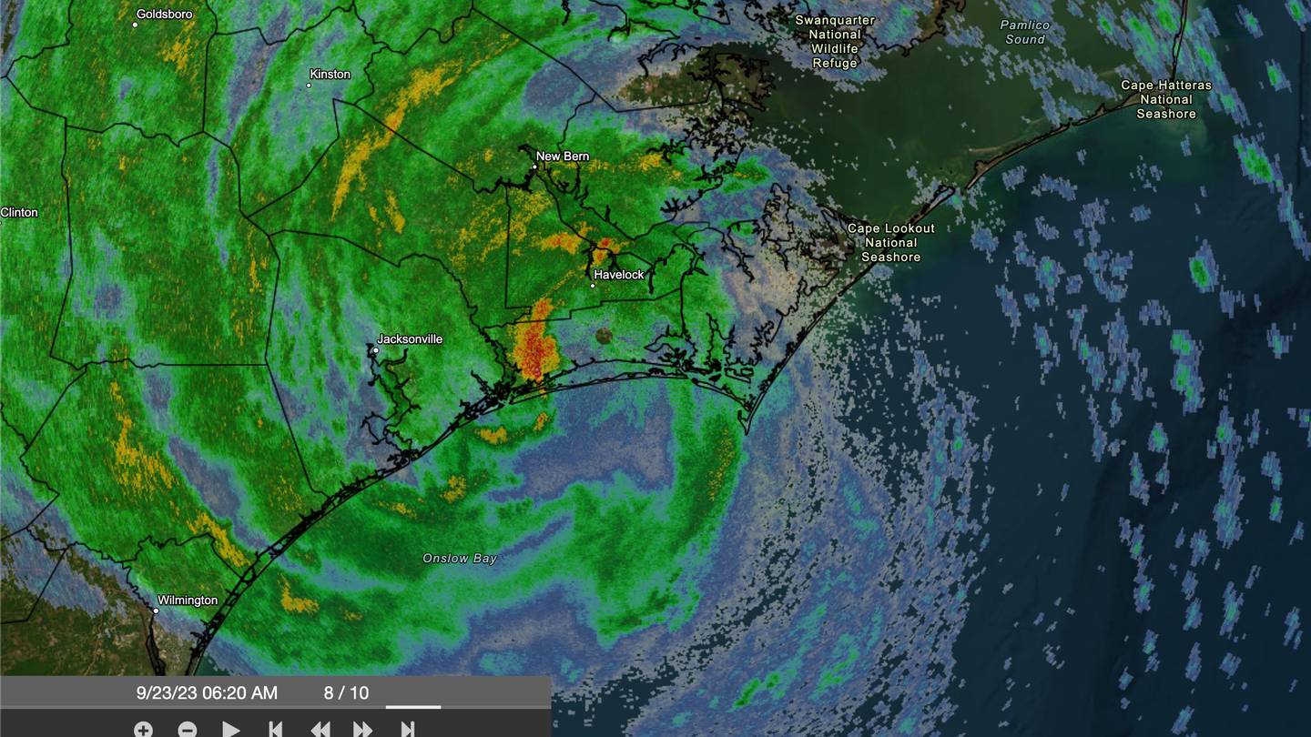
Here is Ophelia, bringing rain, wind, and storm surge to the NC coast and further north.

Follow along with the video below to see how to install our site as a web app on your home screen.
Note: This feature may not be available in some browsers.
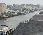
The surfers will be happy. I hope there’s not a lot of flooding when the ocean pushes water up into the tributaries.Here is Ophelia, bringing rain, wind, and storm surge to the NC coast and further north.
Surfers should beware, due to the risk of dangerous rip currents. I hope there won't be too much flooding...The surfers will be happy. I hope there’s not a lot of flooding when the ocean pushes water up into the tributaries.
Stay safe friends and evacuate sooner, rather than later!

I hope you'll be okay!In Wilmington, NC there has been bands of rain and very blustering winds for three hours now.
In Wilmington, NC there has been bands of rain and very blustering winds for three hours now.


 www.forbes.com
 www.youtube.com
 www.tropicaltidbits.com
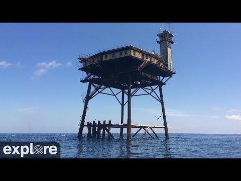
Remember the flagI remember the Frying Pan from another storm off NC:
Frying Pan Ocean Cam powered by EXPLORE.org
Look far out into the Atlantic ocean and watch the weather shift and the day come and go from 34 miles off the coast. Learn more about why this is called the...


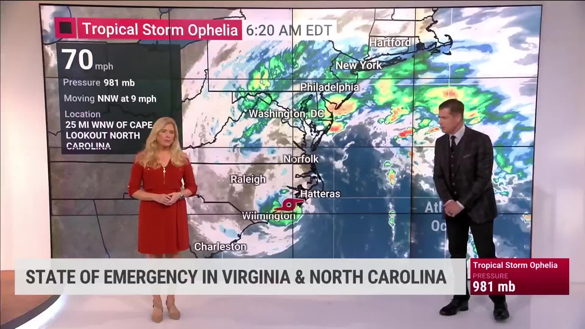
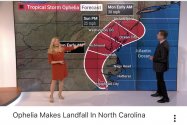
I think it was a minimal Category 1 hurricane at landfall imo, maybe the NHC will upgrade it during post-analysisTropical Storm Ophelia makes landfall in North Carolina
The National Weather Service reports heavy rain, floodng, and coastal surges in eastern North Carolina. Channel 9′s Severe Weather Center Meteorologist Madi Baggett reports on and off showers around Charlotte with breezes around 10-15 mph.www.wsoctv.com
Tropical Storm Ophelia made landfall near Emerald Isle around 6:20 a.m. on Saturday, the National Hurricane Center reports.
Ophelia landed with maximum winds of 70 mph.
Tropical Storm Ophelia Makes Landfall in North Carolina
The National Hurricane Center has reported that Ophelia has officially made landfall in North Carolina.www.wboc.com
Ophelia is expected to move inland and then across portions of southeastern Virginia and Delmarva tonight into Sunday. Tropical storm warnings remain in effect for much of lower Delmarva.
Ophelia Makes Landfall In North Carolina - Videos from The Weather Channel
Ophelia made landfall Saturday morning along the coast of North Carolina. It will bring heavy rain from the Carolinas to New England. - Videos from The Weather Channel | weather.comweather.com