Deceased/Not Found HI - Samuel Martinez, 23, from Nebraska, missed flight home, Kauai, 12 May 2021

No problem, just wanted to point out that his reserved campsite in the state park was very far away from his reserved campsite on the beach.
This, along with a lack of experience, was what really stuck out to me.
I'm hoping that Sam has been staying somewhere else on the island and has just lost track of time

Lost track of time, found and island soulmate, shacked up, and dropped out. That's a nice thought.
 
According to Hoosier952's map campsite #4 is on the beach. That's what I was referring to when I said hiking down to the coast.
In the news story below his parents say that he had a reservation for the coastal trail.

How was he planning to get to his reserved campsite on the coast from where was camping in the state park?
Hike there?
Hitchhike for 2.5 hours between each trailhead?

Samuel was actually described as an inexperienced hiker...

"He has hiked before but he's not experienced," Ted Martinez said

Kaua'i safety officials scour hiking trails for Nebraska man who has been missing for 5 days

Someone also mentioned that his backpack, tent, and sleeping bag were recent purchases which IMO indicates he was very new to backpacking

I've been wondering about his proposed site #4. It's not realistic as far as hiking. That's a first night or last night trail, straight from airport to there or straight from there to airport. Maybe it was the only night a reservation was possible, but I'm not sure what he planned on doing if he couldn't manage to hitch a ride.

Based on last known sighting, it points to something happening between camp #1 and camp #2. There are at least 3 streams he'd need to cross, and if there were heavy rains on the 14th, flash flooding could have been a definite danger through that stretch. It would be nice to know how much research he had about the terrain and the dangers of that type of terrain. I also noticed on his itinerary, he doesn't appear to have a site reserved for the night of 5/13. Every other stop has an overlap. 5/12-5/13, 5/14/-5/16, 5/16-5/18, 5/18-5/19, etc. I don't know if that was a mistake copying his itinerary from paper to FB or if it was planned or an oversight on Sam's part. Going into a full day of hiking after a night of no sleep, potentially in bad weather, just seems like a recipe for disaster, especially for an inexperienced hiker.

#4 really throws me off because it's the only camp that's not in the kokee area.

It doesn't make any sense that he would camp in kokee, go all the way to the coast (2.5 hr drive), and then travel all the way back to kokee (2.5 hour drive) just to stay in a campsite right next to the one he was staying at before he left to go to the coast. I am getting a feeling there is an error in this itinerary, especially since you noticed a date missing...

That aside, I'm going to shift my focus from camp #4 because, as you mentioned, it appears he disappeared before leaving kokee...

Looking at a trail map, the most direct way to get from camp #1 to camp #2 is mostly traveling via a dirt road. If he was hiking on a dirt road there would be significantly less dangers to consider vs a hiking on a trail. Also flash flooding would have to be a lot more severe to impact a road vs a trail.

There are so many different routes in this area though - the map is so messy with roads and trails; we have no way of knowing if he took the most direct route (road) or took a longer route (trail).

The biggest thing that struck out to me looking at the area around camp #2 is the waterfalls in the vicinity, moeloa falls, and mohihi falls.
Both of these falls lack a trail, but people often go off trail to try to find waterfalls
 
I've been wondering about his proposed site #4. It's not realistic as far as hiking. That's a first night or last night trail, straight from airport to there or straight from there to airport. Maybe it was the only night a reservation was possible, but I'm not sure what he planned on doing if he couldn't manage to hitch a ride.

Based on last known sighting, it points to something happening between camp #1 and camp #2. There are at least 3 streams he'd need to cross, and if there were heavy rains on the 14th, flash flooding could have been a definite danger through that stretch. It would be nice to know how much research he had about the terrain and the dangers of that type of terrain. I also noticed on his itinerary, he doesn't appear to have a site reserved for the night of 5/13. Every other stop has an overlap. 5/12-5/13, 5/14/-5/16, 5/16-5/18, 5/18-5/19, etc.

Wait...he didn't have a site for 5/13?!
What if he made a mistake not reserving one and then had to leave the park because they were all full?
 
Wait...he didn't have a site for 5/13?!
What if he made a mistake not reserving one and then had to leave the park because they were all full?

Like I said, I'm not sure why there's no overlap that night. It could have easily been someone writing out his itinerary copied the dates incorrectly or missed a reservation. I really think at this point it's likely not relevant at all. It was just something I noticed.
 
HUNTING
Allowed only on weekends and holidays in designated areas. Must obtain license, adhere to season regs. Check-in stations (clipboard in booth), not manned. Illegal hunting is not unheard of.

WATER
Numerous streams/springs. Most campsites have restrooms with non-potable water.

WEATHER
In close proximity to Mt. Waialeale (once dubbed “the wettest spot on earth”), it does not always rain up at these state parks. At higher elevations, clouds sometimes roll in. There might be fog in some areas depending on weather conditions. See: Driver survives 175-foot plunge off Koke'e road | The Garden Island “It was foggy and wet. There was dense fog and the road was slick,”
 
OVERSIGHT
Two state departments take care of the parks and facilities: Department of Land and Natural Resources (DLNR) and the Parks Dept. Parks employees make the drive daily and do their rounds maintaining the facilities. Duties range from collecting the trash to mowing. DLNR’s LE officers have jurisdiction in the park systems. Kauai Police Department (KPD) has jurisdiction as well, but it is the DLNR officers whose job it is to specifically check hunting and camping areas.

DENSITY
The areas involved are rural. There are cabins (state-owned “recreational residences” inhabited by lessees) and private campsites scattered around in various areas. NASA, the Navy and ANG have a presence there. The amount of cars traveling along the road is steady throughout the day; very few cars if any are on the road after dark as there are no streetlights. 2004 stats: 7% of the total traffic were residents (going either to work or to their DLNR leased cabins); the other 93% were visitors.

ROAD
Two lanes. In many places, the shoulder is nonexistent. Where it passes Waimea Canyon, there are a few areas where the only thing between you and a steep drop is the guardrail. There are stretches where there is no guardrail, just vegetation, some of which might be concealing a ditch or drop-off.

The edge is literally right there. As in this report: “it appeared the vehicle was traveling in a northerly direction, towards Koke’e, went off the road near a curve, skirting around the southern edge of a guardrail before going over the rim of Waimea Canyon.” (same article linked previously) Driver survives 175-foot plunge off Koke'e road | The Garden Island

VEHICULAR TRAFFIC
Majority who make the drive are tourists in their rental vehicles or tour buses. Rental car company offerings range from sedans and convertibles to 4WD SUVs and Jeeps. The pandemic brought with it illegal vehicle rental schemes, a topic for a different board, but this clue might be important. The state DLNR and Parks vehicles are trucks. Hunters all use trucks. For the 75 miles of secondary roads, it’s 4WD only as they are unpaved.

WIDE TRUCKS
In operation is the biomass plant which would place large semis on the road when transporting logs down the mountain. “Up to 10 logging trucks per day will travel between the reforestation site and the plant.” Kauai Biomass Facility to Get Fuel from Burned Forest | Energy Justice Network According to what they are permitted for, they were actively running until May 31. Logging operations involve 20’ or 40’ containers on weekdays from 5 am to 7 pm. May 12 was a Wednesday.
 
The main road takes a beating and is in poor shape. People tend to avoid potholes any way they can, including crossing the center line or driving on the shoulder. Road to Koke‘e a mess | The Garden Island

This guy in his letter to the editor, calls it “path of avoidance”. Letters for Friday, February 21, 2020 | The Garden Island It’s his opinion, but it’s important here because in my opinion, it might help us understand how some people drive, which might be a factor in this case. He says: “This leads to drivers being forced to drive on the shoulder outside the lane, outside of the solid white line. Don’t lie. Lots of us do it.”

PEDESTRIANS
People wanting to get to Kokee are in vehicles; no one walks the whole distance. Where you will find foot traffic are at the trailheads and at opportune photo op areas, including a couple of areas overlooking Waimea Canyon (mentioned previously) where there is no shoulder.

Undoubtedly, this guy doesn’t mean that people are shoulderless, but it describes the dangers of certain areas: “Traveling up to Kokee State Park you will find people (walking along side of the road without shoulders), vehicles, buses and semis. It is a great recipe for an accident waiting to happen, especially at the scenic areas.” Letters for Sunday, August 11, 2019 | The Garden Island Again, some guy’s opinion, but he cared enough about what he witnessed to point it out and in my opinion, it validates the dangerousness of walking on the road, particularly the road in question. I think we need to grasp the whole picture so we can help gather clues to solve this and find Samuel.
 
LAYOUT
The “road” is really one main road that merges into another to continue up the mountain. Waimea Canyon Drive (WCD) is 6.7 miles, running from Kaumualii Highway and ending at Kokee Road. Waimea Canyon State Park starts at the junction of WCD and Kokee Road; the sign is on the right before the intersection.

From there, it’s another 6 mile stretch until you reach “civilization” (where the DLNR cabins are). There are no residences or cabins prior to that. Any buildings you see on Google maps on the desolate stretch are utility or hunter check-in booths.

Waimea Canyon Lookout is at mile marker 10.
The Kokee State Park sign is approximately at mile marker 14 on Kokee Road.

You can enable Street View and “walk” the road to see the conditions I’ve described. Here are screencaps of images owned by Google. Notice the tour bus crossing the center line.
 

Attachments

  • Screenshot_20210612-210712.png
    Screenshot_20210612-210712.png
    726.3 KB · Views: 38
  • Screenshot_20210612-214157.png
    Screenshot_20210612-214157.png
    691.4 KB · Views: 45
  • Screenshot_20210612-214207.png
    Screenshot_20210612-214207.png
    681.2 KB · Views: 44
There's little room to walk in some stretches. Where would one go to get out of the way of a vehicle that was suddenly approaching? Imagine these areas at night.

(More Google images.)
 

Attachments

  • Screenshot_20210612-212544.png
    Screenshot_20210612-212544.png
    676.2 KB · Views: 39
  • Screenshot_20210612-212602.png
    Screenshot_20210612-212602.png
    667.7 KB · Views: 41
  • Screenshot_20210612-212615.png
    Screenshot_20210612-212615.png
    894.6 KB · Views: 38
PICTURES
Drawing from the pictoral clues, the Amazon purchases are not inexpensive items.

Photo of Samuel in the blue shirt looks like the restroom at Lihue airport.

Other photo looks like a restroom as well. He’s wearing a jacket in this one. Could be his start picture or at a layover airport? Can’t read the COVID poster to see what airport it might be. One thing I notice is that for someone flying out to adventure in Hawaii, he’s not smiling. How many of us take selfies and not smile if we’re happy to be wherever we are? Sleuthers, chime in.

The maskless one might be on Kauai. I notice the power pole in the background and it’s either later in the day or overcast. But still no smile on Samuel. It would be helpful to know when this was taken. Could this be from the Snapchat? Does anyone have screencaps of those?

Picture source: ‘Help him come home’: Parents of UNL student missing in Hawaii asking for help
 

Attachments

  • 20210613_043205.png
    20210613_043205.png
    596.7 KB · Views: 80
25 years ago i would go alone to kauai many times alone. I would hike places only helos would go. I was in my 20's and had this idea all locals were kind caring people. I trusted them all. Found out different later on in life during my travels there.
I was giving two locals rides back from a beach family picnick. Almost got out of the parking lot, saw a homeless guy i knew on a blanket in front of my car in grass. I stopped to say hi. The guy in back got mad. I got mad and barely got him out of my car. His buddy in front passenger seat local also said very calmly, you know he was going to bring you to the ranch and you would have never been found. Close call for me being a nice trusting person. I had a local attack the side of my car at night parked in a lot at night next to a beach.
I came close to being washed off a lava beach jutting out over ocean. Looking at sea turtles in crashing waves on a rocky lava beach. 1 second after walking back away from edge a very large wave broke over lava beach and it would have knocked me in. I would have drown.
No one around
I use to talk alot to guys that were not local that slept on beaches every night. They all told me that its very dangerous. There are locals that prey on them, beat them up and or steal whater they have. This is very common and is a risk every night on beach.
There are gang members on this island also. Some have branding burnt into there arm.
Most locals hate visitors. I never knew this when i was young. It is not really safe to stay there alone camping, getting picked up by anyone hitchhiking. The islands travel depts keep it quiet because they dont want it to stop tourism due to the money it brings in.
If you are attacked or victimized by local they know how to make sure your never found.
Was he naive about the crime that occurs there and alot are not friendly and see tourist that are alone as easy targets for crime?
Many locals ARE very kind and caring. Dont get me wrong.
I also jumped boulder to boulder all the way up the waterway in the wettest spot on earth for 5 hours each way. Mountains on each side of me with tops in the clouds all the way. Waterfalls extending all the way down. By myself. The jungle was so thick you couldnt walk through it. Only on boulders up the stream. Stupid of me. Broken ankle and i would have never gotton out and never found. Only life i saw whole time was helos with tourist flying over.
Many ways to be injured, killed or murdered there being solo and naive with a flower child mentality.
I think he ran into trouble if by accident or victimized.
 
PICTURES
Drawing from the pictoral clues, the Amazon purchases are not inexpensive items.

Photo of Samuel in the blue shirt looks like the restroom at Lihue airport.

Other photo looks like a restroom as well. He’s wearing a jacket in this one. Could be his start picture or at a layover airport? Can’t read the COVID poster to see what airport it might be. One thing I notice is that for someone flying out to adventure in Hawaii, he’s not smiling. How many of us take selfies and not smile if we’re happy to be wherever we are? Sleuthers, chime in.

The maskless one might be on Kauai. I notice the power pole in the background and it’s either later in the day or overcast. But still no smile on Samuel. It would be helpful to know when this was taken. Could this be from the Snapchat? Does anyone have screencaps of those?

Picture source: ‘Help him come home’: Parents of UNL student missing in Hawaii asking for help
His facial expression seems to be the same in the news video photo of him with family/friends so that may just be his normal "smile" or whatever it would be called.
 
The Kauai Police Department is still following up on all leads. Fire crews have had a repelling team working for several days now and plan to follow up on an area with potential signs of disturbance.

Upcoming search efforts also include a dog search team, a drone search team, and experienced hikers being sent on specific routes.

https://www.3newsnow.com/news/local...awaii-for-missing-unl-student-samuel-martinez
 
Many here are posting good info and questions. Local LE, first responders and SAR teams are very capable and know the area well. They have searched the areas and swept campsites. I really hope that this kid is found.

It would be helpful if we knew the exact locations Samuel was confirmed to be at. The map that Hoosier952 made is a great idea. We need to solve this and FIND SAMUEL.
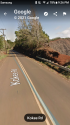
CAMP 10
A sleuther asked why only Camp 10 was checked. For whatever reason, that’s the actual name of that campsite. More on campsite numbers later.

CREATURES
Someone asked about venomous creatures. There are black widows, brown violin spiders, scorpions, centipedes. Was Samuel allergic to bee stings?

Kokee has wild boars. These feral pigs have tusks and carry Brucellosis; they can charge when threatened (Wild Pigs are a Growing Threat to Hikers on the Trail). Hunting (gun or bow) is allowed in certain areas, some of which intersect hiking trails or campsites. Hunters must undergo safety classes prior. There are always lost hunting dogs, but rabies is not a factor as this does not exist in Hawaii.

FORAGING
There are no fruit stands in the area as was suggested by a sleuther. There are plum trees, but they are not in season. Guavas are in season, but they are at a lower elevation than Kokee State Park.
Was going to bring this up. When an attack happens, it can kill someone either from blood loss or infection if not treated right away.
 
Like I said, I'm not sure why there's no overlap that night. It could have easily been someone writing out his itinerary copied the dates incorrectly or missed a reservation. I really think at this point it's likely not relevant at all. It was just something I noticed.

I think it could be very relevant if it was a mistake on Samuel's part. What if he ended up not having a place to camp in kokee on 5/13 and had to leave the park? If we could get a confirmation on his itinerary it could clear this up, but until then I think this could be a very important detail. I've definitely had to leave places before because of reservation mistakes and no last minute camping being available
 
Last edited:

Members online

Online statistics

Members online
89
Guests online
4,218
Total visitors
4,307

Forum statistics

Threads
592,400
Messages
17,968,406
Members
228,767
Latest member
Mona Lisa
Back
Top