freefallzzzz
Well-Known Member
- Joined
- Apr 11, 2009
- Messages
- 3,773
- Reaction score
- 852
This was an early lead on June 4.
10:44 p.m. A caller to 9-1-1 wants to make sure officers have checked the train tunnel in the area near the school. She says "sometimes kids play in there, wants to make sure someone has checked that."
Where is this tunnel?How far away from the school is it?Walking distance?May I please ask if someone has a picture of it?
Hey, where did you get that quote? Was that on a 911 report website? -)
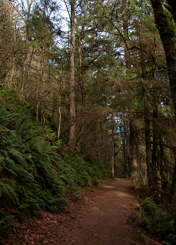
Here is my photobucket of Cornelius Pass Rd which includes pictures
of the "east" end of the tunnel.
As you can see, you cannot walk down the road to the tunnel...
The terrain has deep ravines and is hilly and full of brush, I do not think it
would be a simple easy stroll adding that there is private property (fences) between the school and the tunnel entrance.
Hope this helps..=)
http://s160.photobucket.com/albums/t166/ubrmel/KYRON/skyline corn pass rock quarry in order/