Freo Tide info according to wolfram alpha sourced from their database (sorry, manage attachments doesnt seem to work for me)
20Jun88 - High Tide 1.1m 11.35am - Low Tide .7m 9.31pm
21Jun88 - High Tide 1.03m 11.52am - Low Tide .73m 8.27pm
22Jun88 - High Tide .97m 10.07am - Low Tide .76m 8.25pm
Sunrise around 7.20am all 3 days - sunset approx 5.20pm.
Moon set by 12.30am at latest
The groyne looked very different in the 80's compared to today. It didnt have large protruding boulders encasing it on all sides, instead, most of the rocks were almost level with the flat concrete. If my memory serves me correctly, there were at least 2 sections that you had to take a considerable step down to get onto the rocks too. One was about halfway down to the right and Im pretty sure the end dropped off most of the way around. I remember watching people surfing "The Cove" to the left being able to run the length and jump off quite easily without having to clamber over boulders. It was really dark at night time too. We were sitting out there one night after a party at the surfclub when they switched off their lights & we had to wait until our eyes readjusted enough to be able to climb off, which we did as quick as we could. I dont ever recall a time that it didnt have access for a car to drive down there either. Quite often the path was completely covered with sand and therefore not visible, but Im pretty sure its always been there.
The beach itself changed alot too as Id imagine it still does today. Sometimes you could step straight from the sand onto the bitumen below the now Indiana Tea Rooms, sometimes you had to climb up & other days you'd have to walk around to the stairs. The same went for getting in and out of the water. The bank was so high at times that you could jump straight from sand into waist deep water and you'd have to swim south to get out closer to the groyne and walk back.
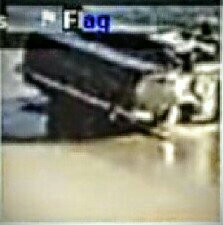
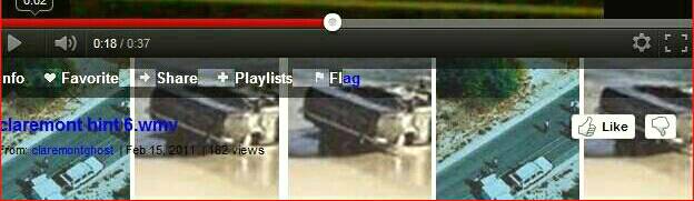
For whats its worth, the fact that the car ended up in the ocean is the least baffling aspect to me whether it was driven off the sand or the groyne, either is possible IMO. The damage sways me to the groyne but the lights being on makes me think it was driven off the sand. Ive always wondered if the backseat could have been kicked out somehow, perhaps by someone trapped in the boot but not making it to shore. Or maybe it had "evidence" on it that someone was trying to dispose of and thought throwing it into the ocean was a good idea then once they got there they realised they could get the whole car in as well. Surely it had to be a hastily made decision rather than a plan.
Finally... Ive been searching for a photo for 2 days that shows the groyne as I remember it - here it is. I have no idea when this was taken but I would say it would have to be close to that time. At the least, it is a better indication of how the groyne looked compared to today anyway. Again, sorry about the attachment issue, check this link. https://www.wa.gov.au/sites/default/files/western-australia_0.jpg
20Jun88 - High Tide 1.1m 11.35am - Low Tide .7m 9.31pm
21Jun88 - High Tide 1.03m 11.52am - Low Tide .73m 8.27pm
22Jun88 - High Tide .97m 10.07am - Low Tide .76m 8.25pm
Sunrise around 7.20am all 3 days - sunset approx 5.20pm.
Moon set by 12.30am at latest
The groyne looked very different in the 80's compared to today. It didnt have large protruding boulders encasing it on all sides, instead, most of the rocks were almost level with the flat concrete. If my memory serves me correctly, there were at least 2 sections that you had to take a considerable step down to get onto the rocks too. One was about halfway down to the right and Im pretty sure the end dropped off most of the way around. I remember watching people surfing "The Cove" to the left being able to run the length and jump off quite easily without having to clamber over boulders. It was really dark at night time too. We were sitting out there one night after a party at the surfclub when they switched off their lights & we had to wait until our eyes readjusted enough to be able to climb off, which we did as quick as we could. I dont ever recall a time that it didnt have access for a car to drive down there either. Quite often the path was completely covered with sand and therefore not visible, but Im pretty sure its always been there.
The beach itself changed alot too as Id imagine it still does today. Sometimes you could step straight from the sand onto the bitumen below the now Indiana Tea Rooms, sometimes you had to climb up & other days you'd have to walk around to the stairs. The same went for getting in and out of the water. The bank was so high at times that you could jump straight from sand into waist deep water and you'd have to swim south to get out closer to the groyne and walk back.
For whats its worth, the fact that the car ended up in the ocean is the least baffling aspect to me whether it was driven off the sand or the groyne, either is possible IMO. The damage sways me to the groyne but the lights being on makes me think it was driven off the sand. Ive always wondered if the backseat could have been kicked out somehow, perhaps by someone trapped in the boot but not making it to shore. Or maybe it had "evidence" on it that someone was trying to dispose of and thought throwing it into the ocean was a good idea then once they got there they realised they could get the whole car in as well. Surely it had to be a hastily made decision rather than a plan.
Finally... Ive been searching for a photo for 2 days that shows the groyne as I remember it - here it is. I have no idea when this was taken but I would say it would have to be close to that time. At the least, it is a better indication of how the groyne looked compared to today anyway. Again, sorry about the attachment issue, check this link. https://www.wa.gov.au/sites/default/files/western-australia_0.jpg