Found Deceased Spain - Esther Dingley, from UK, missing in the Pyrenees, November 2020 #6

Status
Not open for further replies.
See ^^^ about why Largay is not a comparator on point.

Would you mind citing another source and example? In France? The Pyrenees? <modsnip>

When I say "Any case of a missing hiker where remains are found would have checks to eliminate foul play" that is not the same as saying LE would be involved, but it stands to reason any autopsy/examination of remains would include looking for any suspicious signs. <modsnip>
 
Last edited by a moderator:
Could you maybe cite some French examples where LE has pursued a criminal inquiry in a "missing hiker found deceased" case without a tip that a crime might have taken place?
No, of course not. Why would there be a criminal inquiry in a case with no evidence of a criminal act? Let's be clear that the involvement of the Gendarmerie in no way implies that a crime has been committed, or is suspected.

Where LE/SAR kept trying trying trying to find the remainder of the remains of someone who has been "missing found deceased" in the mountains? In the Pyrenees?
It may take a little time to come up with examples. My French is quite rusty.

At the very start, LE made clear that they don't search interminably: it's not in the nature of mountains to make known where the dead are.
I wouldn't expect the Gendarmerie to search interminably in any case, but the circumstances are now rather different from the start of the case. What was at first a search for a missing person became (as time wore on) a search for a person missing presumed dead, and has become a search for the remains of a person confirmed to have died. The conditions in the mountains are also very different in summer than in winter.

Backcountry and mountains are not the same as front country when it comes to protocol.
My experience of France (ten years as a resident) is that protocols tend to be uniform and quite inflexible. The area in question is rugged, but not especially remote, and the laws and protocols of France apply there just as they do in central Paris.
 
All mountain rescue teams in France are a branch of the police departments. Therefore, any search for a missing hiker involves police, but involvement of police does not mean that there is suspicion of criminal activity.

"In France the mountain rescue teams are either part of the PGHM branch of the Gendarmes or the CRS branch of the Police."
Meet the mountain rescuer who spent 30 years on the Pyrenees
 
Sorry about the long ramble but some good links here I hope..

Here is a really excellent video showing the walk up from Hospice de France, via Refuge de Venasque, up to the Port de Venasque, then up to Sauvegarde and back down to the Refuge de Venasque. This shows I think exactly the route (in reverse) that ED was expected to walk according to DC's dossier. Pic de Sauvegarde par Port de Vénasque entre Frères ! - YouTube

There are some interesting things from this video:
1. As per DC's dossier, the route down to Hospice de France is relatively easy and it would without doubt be hard to get lost, or fall off any significant height and there seem to be no scree slopes on this bit. If you did fall, you wouldn't fall very far from the main path (unless you strayed off it).Very hard to disagree with DC on this.
2. You get a very good view on the video at 3.36 from the Sauvegarde mountain down to the Boums du Port (lakes at Refuge de Venasque) so it would have been hard to get very disorientated unless there was fog and the weather was reported as excellent.
3. At 6.55 you get a very good view of the path down from Pic de Sauvegarde to the Refuge de Venasque which passes close to the lake. Although not completely impossible, I find it hard to believe she could have unintentionally fallen into the lake from the path.
4. The ground appears hard, rocky and if there was any foul play it is hard to see how she could have been deliberately concealed much.

Further down in the Hospice de France direction, DC reports there was good phone signal and if she had walked down and seen the car park it is likely she might have turned her phone on expecting signal.

The whole area shown on this video has been extensively searched by the search team and also by DC, and also now I expect walked by many people.

All this leads me to the conclusion, as many others have mentioned, that she probably didn't take this route down from Sauvegarde and perhaps she either changed her plan or maybe just felt safer heading back to the Spanish side where she had already been walking. I find it hard to believe that late in the day and on her own she would have decided to take the treacherous route direct from Pic de Sauvegarde to the Port de Glere area which isn't even marked as a path. That means her route down was back to Port de Venasque and from there either (1) French side, direction Refuge de Venasque or maybe further down that evening or (2) to the Spanish side.

On the Spanish side from Port de Venasque, there are three routes (one, directly East completely away from the area- unlikely). One South, down to the Basurta car park and one South West direction of Cascada de Gorgutes (paths here Rando Le Cirque de la Glère par le Chemin de l'Impératrice (randonnee-nomade.com)). If she had taken the one down to Cascada de Gorgutes then that forms the main path up to Port de Glere from the Spanish side (Senderismo: Ibon de Gorgutes y puerto de la Glera por Chesco - Pirineos3000). I would have thought there is a strong possibility this formed her onward route to Port de Glere. That route up goes alongside the Torrente de Gorgutes so a small possibility of a fall into water here exists (
) but I doubt this is likely from the video and maps.

This area on the Spanish side described above has been extensively searched by DC at least (and presumably the search team-Esther Dingley: Partner baffled by no signs of her - BBC News).

However, the area not searched extensively by DC is the French side north of Port de Glere and the area West of this. ED might have got to Port de Glere easily given her fitness and decided to go a little higher East, perhaps to Pic de Sacroux or even Pico Bonneco (2666m). These areas are in the search and rescue area but I doubt it was possible to cover search these areas very easily given the steep topography and probably this area wasn't the first area prioritised.

All of this is relevant because a lammergeier could have moved the bone found a significant distance I think.

Mobile/cellular signal on the Spanish side is interesting (GSMA - Network Coverage Maps). I think the main networks are Movistar and Orange in Spain. As per the map, signal is very network dependent and we don't know what network ED was on. Orange, for example, has no GSM coverage low down in the valley on the Spanish side but there is weak 3G signal. Movistar has excellent 3G and GSM signal. Vodaphone has no 3G signal at all in the whole area (??- don't believe this). None of the signal coverage maps match what DC reports in his dossier on the French side so there are likely local mountain cellular signal propagation effects altering signal strength (ie. this cellular coverage data is likely very unreliable).

Thank you! It does seem that many routes near Esther's suggested routes are easy and safe during good weather. However, research shows that most accidents occur along simple routes, with no significant difference between experienced and inexperienced hikers.

"In a large number of cases, mountaineering and trad climbing accidents occur in passages considered as being particularly easy {24}. Schussman & al. (1990) report that 81% of accidents occurring during courses on snowy or icy terrain, occur during the descent (particularly ill-controlled passage over snow or ice, sometimes with unsuitable footwear). Their analysis is as follows: these accidents very often occur on relatively simple routes, or once the victim has finished the technically difficult section of the ascent, in sectors presenting no major apparent danger. It is interesting to note that experienced mountaineers/climbers are involved as often as others with less experience."
https://www.petzl.com/fondation/foundation-accidentologie-livret_EN.pdf

That said, I have noticed that the hike from Port de la Glere towards Refuge de Venasque, both the long route and the short-cut, are not well explored. This is exactly where the piece of skull was found. That surprises me, particularly since Esther's last texts about her route were that she was still in the same area, and heading to Port de la Glere the following day. After arriving at Port de la Glere (taking her words at face value), she said that she might dip into France.

It is exactly at that point where she would dip into France, with a long, steep, potentially windy and slippery scree slope, that the skull was found. I don't understand why that was not a place where there would be numerous back and forth searches - unless it isn't possible. Perhaps there is only one good route, and any deviation from that route means increased risk.

This is the BBC map provided by Dan (link) regarding his searches. I have added white arrows to indicate the single marked route between Port de la Glere, down the valley and to Refuge de Venasque. I have added a dashed line where there is a short cut that is described as difficult. It's as though he hiked all around the area where the piece of skull was round, almost avoiding the actual location.

upload_2021-8-1_18-33-55.png
 
This is Port de la Glere: seems to be France on the left, Spain on the right.

View attachment 306962

Puerto de la Glera : Photos, Diagrams & Topos : SummitPost

Of note, these photos are taken in August, and there is snow at that elevation.
I see this, and I'm freaked out. Very likely you'd get moist air. And then it went below freezing in November. And you're in a shadow, with grey rock.

I had thought that if you were really caught in a bad situation up there, at dusk with slick surface, tired, knees hurting, the notch there would be the best place to find a nook. At least it would be somewhat more sheltered than the wide-open deep scree slope with no features. Now that I look at it, it might be too wide to give shelter? It might actually funnel wind.

Do you have a close-up of the notch, @otto ? Like, from eye level?
 
Last edited:
That said, I have noticed that the hike from Port de la Glere towards Refuge de Venasque, both the long route and the short-cut, are not well explored. This is exactly where the piece of skull was found. That surprises me, particularly since Esther's last texts about her route were that she was still in the same area, and heading to Port de la Glere the following day. After arriving at Port de la Glere (taking her words at face value), she said that she might dip into France.

It is exactly at that point where she would dip into France, with a long, steep, potentially windy and slippery scree slope, that the skull was found. I don't understand why that was not a place where there would be numerous back and forth searches - unless it isn't possible.
Thanks for reiterating this.

I can't imagine trail-running up that slope.
 
I see this, and I'm freaked out. Very likely you'd get moist air. And then it went below freezing in November. And you're in a shadow, with grey rock.

I had thought that if you were really caught in a bad situation up there, at dusk with slick surface, tired, knees hurting, the notch there would be the best place to find a nook. At least it would be somewhat more sheltered than the wide-open deep scree slope with no features. Now that I look at it, it might be too wide to give shelter? It might actually funnel wind.

Do you have a close-up of the notch, @otto ? Like, from eye level?

I'm not convinced that these temps reflect the elevation in the mountains, but these are the temps for the weather station near Venasque France.

History Weather Data Venasque - Synop | Weather2Umbrella LTD

Click on the calendar to switch to Nov 21 - 22, 2020. It was cold overnight and I'm convinced that there would be snow at higher elevations.

I don't think there was any shelter near the Port de la Glere, or in the valley below. She had to complete the hike between the Port de la Glere and the Refuge de Venasque in one day, and she was wise to hope for a Winter Room.

If she was heading to the Refuge de la Glere, that closes in the second week of October.

Accueil, Refuge de la Glère

I really do wonder what she was thinking taking hiking advice from a complete stranger to hike trails and Refuges that close in October due to Winter conditions.
Thanks for re-affirming conditions. Even if fog drifted in, or there was a local snow squall or sleet, it would be a disaster. LE wouldn't have been aware of this, since this kind of weather activity can be highly localized.
I think maybe she DID want to go to the Refuge de la G, and that's the one she wasn't sure had a Winter Room. She might have been able to look up the Refuge de V on her phone? But Refuge de la G may have been more ambiguous.
 
I see this, and I'm freaked out. Very likely you'd get moist air. And then it went below freezing in November. And you're in a shadow, with grey rock.

I had thought that if you were really caught in a bad situation up there, at dusk with slick surface, tired, knees hurting, the notch there would be the best place to find a nook. At least it would be somewhat more sheltered than the wide-open deep scree slope with no features. Now that I look at it, it might be too wide to give shelter? It might actually funnel wind.

Do you have a close-up of the notch, @otto ? Like, from eye level?

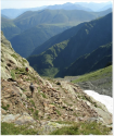
This has been posted before, but it's all I can find at ground level looking down from Port de la Glere so far.

upload_2021-8-1_20-21-5.png

upload_2021-8-1_20-21-42.png
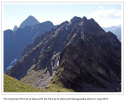
This picture is taken on the first steps of the path between the french-spanish border (at the col known as Port de la Glère/Puerto de la Glera) and the Hospice de France. August 2010

Port de la Glère : Photos, Diagrams & Topos : SummitPost

Look at the photos down the page here, from May 1, 2008. Freezing wind is mentioned.

Senderismo: Ibon de Gorgutes y puerto de la Glera por Chesco - Pirineos3000
 
According to this, the Refuge de la G DOES have a winter room, with no upkeep. The translation isn't great, though, and the info is buried on the page. And, COVID 19 being what it is, how would one know for sure?
Refuge de la Glère : Hut & Campground Information : SummitPost

Not sure whether something is wrong with Google Maps, but I noticed this on the topo map as well. Refuge de la Glere does not seem to be near Port de la Glere. I've been second guess myself thinking that the maps are off.

Assuming the maps are correct, Esther's only option from Port de la Glere was Hospital de Benasque or Refuge de Venasque.

upload_2021-8-1_21-11-9.png

Maps are definitely correct. The Refuge de la Glere is no where near the Port de la Glere.

Google Maps
 
Sorry about the long ramble but some good links here I hope..
That route up goes alongside the Torrente de Gorgutes so a small possibility of a fall into water here exists (
) but I doubt this is likely from the video and maps.
RSBM

Nice job, @Kike76. I appreciate your research. I found this image at 1:57-8s in the Youtube video you referenced, very interesting. I guess this is Port de la Glere looking up from below on the French side. And if that is true, one could imagine all that nicely formed zig-zag trail with stone walls made it a passible trail at one time. You have to wonder if part of that huge scree field are all those shale stones used to make all those stone walls for the path back then.

upload_2021-8-2_0-28-5.png
 
In the Science.Mic article, writer Theresa Fisher spoke with Utah neuroscientist Perry Renshaw about his findings. Renshaw told her that he believes altitude messes with our bodies’ levels of dopamine and serotonin, chemicals that regulate our sense of happiness. Hypoxia, he says, causes serotonin to go down in our brains (which usually results in depression) and dopamine to increase (which usually creates a sense of euphoria, e.g. “runner’s high”).
RSBM & BBM

@NoSI, I enjoyed your research findings in your post. In particular, I tried to assimilate what Renshaw believes about hypoxia - that there may be simultaneous feelings of depression and euphoria. While those seem like polar opposites, I find it interesting when attempting to apply that finding to ED's case. Could she have been chronically hypoxic and if so, appearing happy on the outside (her expressions of euphoria) but at the same time feeling depressed on the inside?

Hi @RedHaus. Thank you so much for reply! As I understand it, most research indicates that mood is initially euphoric and then depressed. Some research also indicates that it may depend if the person was born at altitude. A person born at altitude may not be as susceptible.

Some sources:

"Observed behaviors and personal anecdotes suggest that the initial mood experienced at altitude is euphoria, followed by depression. With time, individuals may also become quarrelsome, irritable, anxious, and apathetic (Van Liere and Stickney, 1963)." The Effect of Altitude on Cognitive Performance and Mood States - Nutritional Needs In Cold And In High-Altitude Environments - NCBI Bookshelf

"What’s interesting is that some people feel better at altitude, while others suffer from the depressive like symptoms. Renshaw suggests that in these cases the increase in dopamine supersedes the decrease in serotonin, and that this likely occurs in those who are born at altitude. These are the people who move away from the mountains and yearn to be back home.
On the flip side, if the drop in serotonin levels predominate then people are more likely to feel the symptoms of depression, anxiety, and so forth." Your Brain on Altitude- How altitude can cause or prevent depression?

"In a 2005 study, the Naval Health Research Center measured mood changes in Marines who left seaside San Diego for 30 days of strenuous training in the Northern California mountains. Before training, the Marines completed a self-evaluation of their levels of anxiety, dejection, fatigue and bewilderment, among other mood symptoms. They completed the same evaluation after training ended, and then again 90 days later. While their physical fitness improved during training, their mental health disintegrated. Before training, the Marines reported more balanced mood levels than average college-aged men. By the time they finished, they described mood symptoms comparable to those of psychiatric patients. Ninety days later, they were just as sad and agitated." Your Brain on Altitude- How altitude can cause or prevent depression?
 
Status
Not open for further replies.

Members online

Online statistics

Members online
183
Guests online
4,179
Total visitors
4,362

Forum statistics

Threads
593,066
Messages
17,980,811
Members
229,012
Latest member
OnceAgain
Back
Top