Found Deceased Australia - Russell Hill, 74, & Carol Clay, 72, Wonnangatta Valley, 20 Mar 2020 #5 *charges*

Status
Not open for further replies.
Jaywill: "I think that it may be an old fashioned bit of slang."

I found a reference to SOL meaning s--- on liver via Google Books in The New Partridge Dictionary of Slang and Unconventional English. Said to mean ill temper, Australia, 1951. That fits. I heard it from a friend's mother, born 1931, who was the source of quite a few crude Australian slang terms I'd never heard before.

Seems there was a band called King Parrot that had a song of the same name in 2012.

But I found another reference that it came from a book, an Australian one ? in 1935
 
How many times did he fly over those parts at relatively low altitudes? Knowing and learning the landscape?
My old man is an old and bold airline pilot himself. I twigged him on this and he says the airway from Sydney to Melbourne does fly over this area normally, but any overflying of this spot is probably about 30-40K feet and at that height you can see towns, lakes and mountains, but nothing as detailed as a campsite or tracks. So I don't know he would have seen anything of value.
 
Last edited:
Yes Russell made the radio contact from the campsite. Russell did go camping the weekend or 2 weekends before, but when we spoke to him he said he was at King Billy 2 which is about 2 hours drive north east of where he was camped in the Wonnangatta valley. He only stayed the one night which we thought was strange as its a long way to go for just 1 night.
Russell's radio was still in his 4WD. I too was curious about that.
Thank you for this info Motomike. It clears up a lot of confusion about Russell's prev visit to the area. If he wasn't even close to the Dry River site it probably means there was no connection between the two visits.
As for the radio being in the car, so were Carol's belongings IIRC, which all points to something happening shortly after they arrived and set up. I am thinking if they had retired for the night when they were attacked, she would have already taken her things out of the car, I know I would have.
Edited for clarity.
 
"The new area of interest is 30km from the campsite"
"Police have used intelligence to target this area in their search"
"It is a very specific area"

Source: Ch7 morning TV news this morning
"Police have used intelligence to target this area" indicates to me that suspect has not volunteered the information and there is a high chance that he is still pleading innocence? Time will tell.

Otherwise I believe this would be worded differently.
 
Search begins for bodies of missing campers

A large group of police will search for the bodies of missing campers Carol Clay and Russell Hill in Victoria’s high country.

Investigators are narrowing in on a dense area of the state’s alpine region 30km from the remote campsite in the Wonnangatta Valley where the pair were last seen after Jetstar pilot Gregory Lynn was charged over their alleged murders last week.
 
SOLVED

"...

It's a different colour to the vehicle police have been zeroing in on but it is the same shape and size.
  • On March 21, their campsite was found burnt out.
  • On March 30, Police made a public appeal for the first time.
  • A year later in 2021 there was a potential breakthrough. On March 5, police made an appeal for information about a white dual cab ute, which was eventually ruled out after the owner came forward.
Major breakthrough in missing campers investigation
Thanks Judi. That clears a lot of it up. Part of the problem was that the press continued to talk about the "mystery dual cab ute" until well into this year.
The interesting thing is that from March police were saying that they had traced all vehicles except the white one. But then in November they revealed their interest in a blue Nissan 4WD and asked for help. However, they also said later that they had spoken to Mr Lynn in 2020. Had they not connected him with the blue 4WD? If not how did they identify him as being in the valley? Ot were they simply seeking additional information on the blue Nissan? In seems inconceivable that they did not know in November about the colour change. Mr Lynn's neighbours certainly did and could give the press an approximate date: late March - May, 2020.
Also, the police have not released whether the black and white photo of the Nissan and trailer, taken near Mt Hotham, showed licence plate. The photos released seems to show it blacked out. I think Brumby Jack suggested the camera would have, as it is intended to monitor and charge for access to Mt hotham which is private. It would also likely to have been in colour. So, I guess a question is from when the police had that photo they would know the owner of the vehicle - and likely driver on that day. And colour changes. It was originally registered as white. I do not know if motor vehicle registration requires an annual check or that records be amended if there is a change in colour. Insurance usually does.
Then there was news stories that aid the google street view showing a Nissan 4WD in Mr Lynn's drive - in 2019 it is blue and in 2021 it is beige - and this "cracked" the case.
 
Thats not quite correct. Russell was discussing with another member of our group possible tracks and campsites he could stop at on the way out, we had no information that he intended to leave the next day.
.....
Motomike
Thanks so much for your comments here. They correct and clarify so much. I and my friends had a couple of questions and some arise out of us watching the Ch.9 missing documentary.
I hope you do not mind our peppering you with questions. We were wondering....
About how long does it take to set up and take down an antenna?
Do you know what time Mr Hill and Ms Clay arrived at the camp site?
I guess also, how long does it take to traverse the Zeka spur? The press say about 2 1/2 hours at about 10km /hr for 23 km. And how long to exit the area if you go east to Talbottville or use the Cynthia track.
How long would it take Mr Hill to set up his camp site?
Do you know whether Mr Hill took a camera or a firearm with him when he went camping?
Could Mr Hill's drone take night vision? - a witness says he was flying it "in the evening", which sounds odd.
Thanks for reading and your time.
 
"Police have used intelligence to target this area" indicates to me that suspect has not volunteered the information and there is a high chance that he is still pleading innocence? Time will tell.

Otherwise I believe this would be worded differently.
I agree.
From police I know socially, they tell me that this is a semi technical term, and it is as you say. It is based not on information received from the public, or interviews, or information given wittingly by the accused. It is technical, meaning from gps, photographs, dash cameras, mobile phone towers and the like - and it can also include analysis of phones the police have seized under warrant. the information is then analysed and a conclusion drawn. At that point they describe it as "intelligence".
 
Resort Entry | Hotham Alpine Resort
Underneath the ‘Do I have to stop at the resort entry toll point?’ tab:

“Mt Hotham’s resort entry system is managed through cameras at the toll points. Your vehicle registration plates will be recorded and matched to your pre-purchased resort entry fee payment. You do not need to stop or print a ticket. If you have not pre-purchased a permit you can do so on mountain at Mt Hotham RMB.”

Also, the police have not released whether the black and white photo of the Nissan and trailer, taken near Mt Hotham, showed licence plate. The photos released seems to show it blacked out. I think Brumby Jack suggested the camera would have, as it is intended to monitor and charge for access to Mt hotham which is private. It would also likely to have been in colour. So, I guess a question is from when the police had that photo they would know the owner of the vehicle - and likely driver on that day.
 
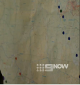
Further to today's developments, I wanted to share some screen grabs from the 60 mins story. If one cuts through the usual 60 mins puffery and quizzical grimaces of the reporter, there was this one shot of a wall of posters. How much of this is staged to rattle the suspect has not been stated. But, there is this one poster that shows red and blue dots on a map. This appears to be a map of the Dargo - Mt Hotham area with the Wonnangatta valley.
What is interesting are the two red dots - on the extreme left. Speculation: thiese represent the camp site and possibly the Myrtleford gate.
The line of blue dots appear to follow the Dargo High Plains road.
The reason this is important is that each dot represents a data point. Do the blue dots represent a sighting of the vehicle, verified by say dash camera?
It seems that these maps show the police had tracked a vehicle along the Dargo High Plains road to Mt Hotham. But at the bottom of the screen grabs are other blue dots.

upload_2021-11-29_12-53-50.png

upload_2021-11-29_12-54-4.png

upload_2021-11-29_12-54-13.png

upload_2021-11-29_12-54-34.png
 
Resort Entry | Hotham Alpine Resort
Underneath the ‘Do I have to stop at the resort entry toll point?’ tab:

“Mt Hotham’s resort entry system is managed through cameras at the toll points. Your vehicle registration plates will be recorded and matched to your pre-purchased resort entry fee payment. You do not need to stop or print a ticket. If you have not pre-purchased a permit you can do so on mountain at Mt Hotham RMB.”
Brumby Jack
Thanks heaps for that.
The 60 mins program shows the cameras - and there is a shot that shows the road, cutting on LHS where the 4WD was snapped.
A question. It is a long time since I travelled up the Dargo-Harrietville road, but you do not need to pay a toll if you are going from Dargo to Harrietville or simply along the Great alpine road, do you? Its only if you go into the resort. Is that correct?
 
As there seems to be no official word publically on whether a confession has been made yet, I wonder whether LE are searching particular areas based on educated guesses?

Perhaps LE have gone out there in similar conditions after dark to retrace possible path of the alleged on the night RH and CC were last seen.

Decisions on where one may go may differ between day and night. For example an area that may seem secluded at night may reveal itself to be relatively open space with long line of sight during the day.

Also I wonder whether the alleged may have returned to the scene to relocate to a more concealed spot at a later date? I can't imagine that RH and CC would be found very far from a track at all, especially if they were essentially the same location now as the night they were (allegedly) left somewhere.

However if more effort was (theoretically) made to hide them later on, where they could be expands from a few possible candidate locations to literally anywhere in the state / region.

All speculation and imo
 
Jaywill: "I think that it may be an old fashioned bit of slang."

I found a reference to SOL meaning s--- on liver via Google Books in The New Partridge Dictionary of Slang and Unconventional English. Said to mean ill temper, Australia, 1951. That fits. I heard it from a friend's mother, born 1931, who was the source of quite a few crude Australian slang terms I'd never heard before.
Built like a brick ****house.
 
I was wondering whether GL said something incriminating, out loud to himself when he was alone, about the area now being searched, while either being bugged at home or in the car, that's if he was bugged.

Or like that US case man who said something out loud when he was alone in the rest room during questioning.

Also they may have been keeping tabs on his internet searches.

I could very well be wrong but I can't see him admitting to anything.
 
Status
Not open for further replies.

Members online

Online statistics

Members online
77
Guests online
3,068
Total visitors
3,145

Forum statistics

Threads
592,621
Messages
17,972,028
Members
228,846
Latest member
butiwantedthatname
Back
Top