All I can offer there is a hunch (wild speculation on my part). If this is beyond the rules for this thread, could a moderator please delete my post.
Beyond the rapids I described just upstream of the converter station, there appear to me no more between there and Hudson Bay.
I've long felt that areas of interest should include the tiny ghost towns of Port Nelson and York Factory near the Nelson river mouth (the latter is a few miles south, actually on the mouth of Hayes River). After that... Hudson bay. It's around 400 miles along the coast (a fairly gentile coast from the look of it) to get to the south end of James Bay (at the south end of Hudson Bay) which has a rail line reaching the coast at Moosonee, Ontario. Trying that in an open aluminum skiff... it would take a lot of fuel, and a heck of a lot of luck, plus you'd be passing polar bear sanctuaries.
My best guess is they found themselves trapped in the Gillam region, and didn't think beyond getting away. But I can't rule out that they had some kind of a destination in mind, plausible or not.
I'm also not convinced the aluminum skiff is definitive. Two alternate scenarios for it are it has nothing to do with the suspects, or, they encountered a fisherman camped along the bank, put his or her body in the skiff and shoved it off, then stole his or her car.
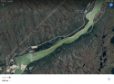
Also, to those asking why such a skiff would be on a river with rapids, most of the river there is fine for a skiff (most of it has no rapids), plus you can easily transport it by car to area lakes. My guess it is was stolen from a camp area marked near Sundance, and the owner was not around, so has no idea it was stolen.

") York Landing is not York Factory. York Landing is SW of Gillam. York Factory is NE of Gillam, out near the mouth of the Nelson River, on the mouth of the Hayes river, on Hudson Bay. They are over 100 miles apart. I do see that several media sources mixed them up a few times, though.
York Landing is not York Factory. York Landing is SW of Gillam. York Factory is NE of Gillam, out near the mouth of the Nelson River, on the mouth of the Hayes river, on Hudson Bay. They are over 100 miles apart. I do see that several media sources mixed them up a few times, though.