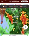
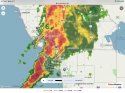
If you're on the GOM, be aware. Storm surge and flooding are the big threat.
Elsa is now expected to become a hurricane before landfall as per the official forecast. Landfall is expected to be just south of Cedar Key, near Crystal River.
Areas just to the right of landfall will likely see the worst of the wind and surge overnight into tomorrow.
Key Messages:
1. Heavy rain will impact Cuba tonight resulting in significant flooding and mudslides. As Elsa moves across the western and northern Florida Peninsula through Wednesday, heavy rainfall may result in considerable flash, urban, and minor to isolated moderate river flooding. Mid- to late-week, heavy rainfall across southeast
Georgia, South Carolina, North Carolina, and southeastern Virginia may result in isolated flash and urban flooding, with considerable flash and urban flooding possible across coastal Georgia and the of South Carolina.
2. There is a danger of life-threatening storm surge along portions of the west coast of Florida tonight and Wednesday, and a Storm Surge Warning is in effect for that area.
3. Hurricane conditions are expected tonight and early Wednesday along a portion of the west coast of Florida, where a Hurricane Warning is in effect. Tropical storm conditions are occurring across portions of the Florida Keys and will spread northward along the west coast of the state within the warning area through Wednesday morning.
4. Although the center of Elsa is expected to remain inland of the coastline from Georgia through the Carolinas during the next couple of days, tropical storm conditions are expected in a portion of southeastern Georgia and are possible elsewhere along much of the coasts of Georgia and South Carolina.
Log into Facebook
")