http://www.fire.ca.gov/current_incidents/incidentdetails/Index/1922
THOMAS FIRE
Thomas Fire Incident Information:Last Updated: December 06, 2017 9:06 pmDate/Time Started: December 04, 2017 6:28 pmAdministrative Unit:Unified Command: CAL FIRE, Ventura County Fire, City of Ventura, Los Padres National Forest, Ventura County Sheriff,County:Ventura CountyLocation:Hwy 150 and Hwy 126, north of Santa PaulaAcres Burned - Containment:90,000 acres - 5% containedStructures Threatened:12,000 structures threatenedStructures Destroyed:150 structuresEvacuations:Evacuation Map
12/6/17 PM - See the latest*Evacuation News Release*for more information.
MANDATORY EVACUATIONS:*
• City of Santa Paula - Boundary of Say Road north to Thomas Aquinas, Dickenson Ranch Road east to Santa Paula Creek*
• City of Santa Paula - Boundary of Monte Vista Street north to city limits, Foothill Road from Steckel to Peck Road to north of city limits*
• Santa Paula unincorporated area towards Ventura- North of Foothill Road from Peck Road to Wells Road including: Wheeler Canyon, Aliso Canyon and Rancho Vista*
• City of Ventura - Teloma east to Brent Street, Telegraph Road north to north of Foothill Road*
• City of Ventura - Victoria Road east to Hill Road, Telegraph Road north to Foothill Road*
• City of Ventura - North Ashwood Avenue east to Hill Road, Telegraph Road north to Foothill Road*
• City of Ventura - North of Foothill Road from Wells Road to Poli Street*
• City of Ventura - North of Main Street from Seward Avenue to Hwy 33 (includes entire Ventura Avenue area)*
• Oak View - Boundary of Hwy 33, Creek Road and Hermosa Road*
• Entire Community of Casitas Springs - Evacuate to Ventura County Fairgrounds - 10 West Harbor Blvd., Ventura*
• East Ojai Valley - Carne Road east to McAndrew Road, Reeves Road north to Thacher Road*
• Upper Ojai Valley - Hwy 150 from Dennison Grade east to Osborne Road and all residences north*
• Ventura County North Coast Area - Boundary of Hwy 33 on the north to Casitas Vista Road, northwest to Hwy 150, Hwy 150 (Casitas Pass Road) west to US 101 and south on US 101 (including Pacific Coast Highway) to Emma Wood State Beach
VOLUNTARY EVACUATIONS:*
• Residents in the City of Ventura, south of Loma Vista, east of Day Road, West of Victoria Avenue and north of Telegraph Road
• Residents in the City of Ventura, east of Victoria north of Loma Vista South of Foothill west of Wells Road*
• All residents of the Ojai Valley not currently covered under the current mandatory evacuation*
• City of Fillmore - Boundary of 2nd Street north to 4th Street & Island View Street east to Pole Creek*
• City of Fillmore - Boundary of 4th Street on the south to Pole Canyon Road, Pole Canyon Road northeast to Goodenough Road, Goodenough Road south to 5th Street and 5th Street southeast to 4th Street*
• City of Fillmore - Boundary of Hwy 23 & the Santa Clara River south to Guiberson Road, Guiberson Road east to Torrey Road and Torrey Road north to the Santa Clara River
EVACUATION SHELTERS:*City of Ventura - Ventura County Fairgrounds at Miners Building (Red Cross - Includes an Animal Shelter for all types of animals) – 10 W Harbor Blvd, Ventura, CA 93001*
City of Ojai - Nordhoff High School (Red Cross) -1401 Maricopa Hwy, Ojai, CA 93023*
City of Oxnard - Oxnard College Gymnasium (Red Cross)- Open 12/5/17, 0700*
City of Santa Paula - Santa Paula Community Center (City of SP run shelter) - Open 0800*
City of Fillmore - Veteran's Memorial Bldg (City of Fillmore run shelter), 511 2nd Street - Will be open 12/6/17, 0800 hrs*
UC Santa Barbara - Santa Barbara Multi Activity Center, 552 University Road, Santa Barbara, CA
Road Closures:ROAD CLOSURES:*Road closures continue to impact Highway 150 and Highway 33, as well as many other city and county roads.
Per California Highway Patrol:*
Hard Closure- SR-150 at Reeves Road (east end Ojai Valley)*
Hard Closure - SR-150 at Stonegate (Santa Paula)*
Hard Closure - SR 150 at Telegraph Road (Santa Paula)*
Hard Closure - SR 150 at Richmond Road (Santa Paula)*
Hard Closure - Foothill Road at Olive/Cummings/Wells/Briggs (Santa Paula/Ventura area)*
BREAKING UPDATES:*
Ojai Area - Traffic is currently open for Hwy 150 (Casitas Pass Road) to US 101 (Carpenteria)*
Casitas Springs area - Creek Road north of Hwy 33 closed.
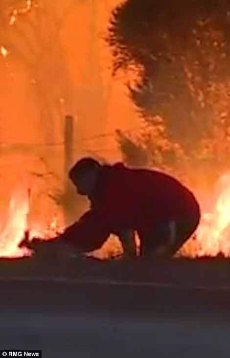
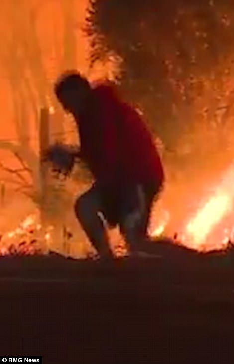
Cooperating Agencies:CAL FIRE, Ventura County Fire, Ventura County Sheriff, City of Ventura Fire Department, City of Ventura Police Department, USFS/Los Padres National Forest, CAL OES, Red Cross, PG&E, CHP, Ventura County Public Works, CALTRANS, California Dept. of Corrections and Rehabilitation.Total Fire Personnel:1776Total Fire Engines:362Total Fire Crews:32Total Helicopters:12Total Dozers:19Total Water Tenders:4Incident Management Team:CAL FIRE IMT-4Long/Lat:-119.09124/34.41521Conditions:The fire continues to burn actively with extreme rates of spread and long range spotting when pushed by winds. The fire is established on the north and east side of Hwy 150 and is also burning on the west side of Hwy 30. The fire has pushed northwest of Ventura and has reached the Hwy 101. Firefighters continue to work aggressively to protect life and property while working on control efforts around the fire perimeter.
SCHOOL CLOSURES:*Fillmore Unified School District, Hueneme Elementary School District, Mesa Union Elementary School District, Moorpark Unified School District, Mupu Elementary School District, Ocean View School District, Ojai Unified School District, Oxnard Elementary School District, Oxnard Union High School District, Pleasant Valley School District, Rio Elementary School District, Saint Anthony's School, Santa Clara Elementary School District (Santa Paula), Santa Paula Unified School District, Simi Valley Unified School District, University Preparation Charter School, VCOE Career Education Center Sites, VCOE-Operated School Sites and Classrooms, Ventura Unified School District, Moorpark College, Oxnard College, Ventura College, Thomas Aquinas College
12/6/17 PM - See the latest*Incident Update*for more information on this fire.
Phone Numbers(805) 465-6650 (Thomas Fire Information Line ) *
California Statewide Maps
View*California Fire Map*in a larger map*
Current Statewide Fire Information
INCIDENT INFORMATION MORE INFOIncident MapsPhotosNews ReleasesWeather InformationTelephone NumbersSpecial NoticesRelated Links
http://www.fire.ca.gov/current_incidents/incidentdetails/Index/1922