Canada - Lucas Fowler, Chynna Deese, and Leonard Dyck, all murdered, Alaska Hwy, BC, Jul 2019 #8

Status
Not open for further replies.
Manhunt for B.C. teen fugitives moves on as RCMP end search in Manitoba First Nation

Split Lake encounter with band constables is certainly credible. They stop ALL vehicles as a policy, but the RAV4 didn't stop. So 2 constables pursued the vehicle and made it stop. They explained the rules about alcohol.

The men apologized and made an excuse that they were looking for gas. Their purchase of only $20 worth of gas was AFTER this encounter. They confirmed the alcohol policy with the clerk.

RCMP must have checked approximate times of these two encounters with the report of vehicle on fire.
 
RE last few pages of comments about power lines/ hydro lines/ pylons

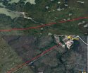
The double lines you see on sat are the hydro lines

People are talking about them because they are an "easy" path that leads directly between last 2 sightings

"difficult but possible" locals say

This was discussed a few times over last few days heres some relevant maps, and a pic that shows how much clearer under the lines compared to surrounding bush.

Could also mix in, at different points using the tracks or various trails of which there are many.
 

Attachments

  • JustAnIdea.jpg
    JustAnIdea.jpg
    105.4 KB · Views: 18
  • Start-finish.jpg
    Start-finish.jpg
    176.2 KB · Views: 20
  • hydrolinewalk.jpg
    hydrolinewalk.jpg
    147.6 KB · Views: 21
  • upload_2019-7-29_11-2-58.png
    upload_2019-7-29_11-2-58.png
    444 KB · Views: 19
  • doable.jpg
    doable.jpg
    93.5 KB · Views: 19
Yes, if their phone is still charged (and now they have those back-up thingies, which is totally possible - mine keeps my phone charged for brief daily use while traveling for about 2 weeks)...then GPS would be the one thing they'd be most likely to be able to use (downloaded map and all from before).

So...that's direct to satellite and not through a tower, right? Someone please explain (again) how the GPS differs from using Cellular network.

PS. I'm the one who said that my teenage-24 year old students have a rough time with paper maps and figuring things out without that blue dot showing them where they are - but they catch on after a couple of weeks of practice.
Most new phones have a GPS built in and can find the satellite GPS signals without needing a cell phone tower. That gives a map app a location and then you can plot your course from there, whether you are in BC, AU, Nepal. Sometimes if lots of clouds and bad weather there can be a problem.
 
Plausible, and good theory but a couple things why it doesn't add up for me:

I wish we knew if LF carried a firearm (I might've missed this info if he did have a gun). LF doesn't strike me as the type to carry one though, I think it's hard to get firearms over the Canadian border too(?)

I still think they could've flown under the radar much easier if ditched their truck in the bush or drove off a ravine, lighting it on fire drew attention to them so I have to think they wanted the notoriety, JMO.

I think LF had been working on a ranch in BC for several months, hadn't he? Long enough to legally aquire a long gun for a trip into the far north where self reliance is essential.
 
There is zero evidence that he had a gun. Having had a permit to transport a gun between the US and Canada (I shoot skeet in both countries), I can tell you that it’s a huge rigmarole and takes months to arrange.

Thanks for clarifying! That's what I thought - a big headache to take a gun. Realistically, in Canada most people don't need a reason to be packing heat while on a fun trip. I know it probably happens but with this couple I just think doubtful.
 
If you trust the recollection of the Band personnel who checked them re alcohol, there were paper maps in the car.
Probably Mr. D's maps, he went camping a lot and it apparently was his car and he would have had all the equipment he needed for his trip.
 
So, possibly following that theory, the next logical path would be to Kelsey if they were in York Landing and planned for an escape or back up towards Gillam. Rail lines would need to be on firm ground. What about Power Lines? I know we have clear paths in Ontario but would they be boggy out in Manitoba or require some firm ground for repair crews to access if needed?
You know that if you follow hydro lines you will eventually find a town. Manitoba Hydro map. Google Image Result for http://manitobawildlands.org/maps/MB-Hydro-facilities_map_lg.jpg
 
Manhunt for B.C. teen fugitives moves on as RCMP end search in Manitoba First Nation

Split Lake encounter with band constables is certainly credible. They stop ALL vehicles as a policy, but the RAV4 didn't stop. So 2 constables pursued the vehicle and made it stop. They explained the rules about alcohol.

The men apologized and made an excuse that they were looking for gas. Their purchase of only $20 worth of gas was AFTER this encounter. They confirmed the alcohol policy with the clerk.

RCMP must have checked approximate times of these two encounters with the report of vehicle on fire.

I had to laugh when the band constable said they kept saying sorry. So Canadian. Even our multiple murderers are properly indoctrinated.
 
I saw in a report way back that the RCMP also took negotiators to Gillam, but there has been no attempt to use them, no attempts at negotiations to get them to surrender themselves. No parent at news conference asking them to surrender to police etc. Just police and military presence, which has been shown to be of no use for the past week.

I find the lack of parents involvement confusing and somewhat disturbing.
 
No evidence but, IMO, certainly reason to believe, or at least consider. Fowler was an experienced traveller who had been in Canada long enough to qualify for the legal acquisition of a long gun to protect against wildlife in a northern camping adventure. (Did he do so?). The teenagers from Pt Alberni most certainly could not have met the requirements. Maybe they could have acquired one illegally? Port Alberni is a long way from the US/CAN border. Most illegal guns are tossed over the fence to gang members in Vancouver or Windsor Ont. MOO

There was nothing preventing McLeod or Schmegelsky from getting a gun license. There’s reason to believe that Schmegelsky didn’t have one, but McLeod may have. We just don’t know.

For the reasons explained in earlier posts (see posts 920, 926, 930), it would make very little sense for Fowler to get a license in Canada, and there is zero evidence that he had one.
 
RE last few pages of comments about power lines/ hydro lines/ pylons

The double lines you see on sat are the hydro lines

People are talking about them because they are an "easy" path that leads directly between last 2 sightings

"difficult but possible" locals say

This was discussed a few times over last few days heres some relevant maps, and a pic that shows how much clearer under the lines compared to surrounding bush.

Could also mix in, at different points using the tracks or various trails of which there are many.
Thanks, I have been looking for Hydro companies plans of where their tunnels/lines run there!
 
I think LF had been working on a ranch in BC for several months, hadn't he? Long enough to legally aquire a long gun for a trip into the far north where self reliance is essential.

Sure and good point. It's just when me and my friends were that age doing road trips, last thing on our mind was getting a gun. Things have changed though. The couple looked like not much packed and a bit hippie-ish, so I guess they don't seem like gun-toting people to me (assumption!)
 
RE last few pages of comments about power lines/ hydro lines/ pylons

The double lines you see on sat are the hydro lines

People are talking about them because they are an "easy" path that leads directly between last 2 sightings

"difficult but possible" locals say

This was discussed a few times over last few days heres some relevant maps, and a pic that shows how much clearer under the lines compared to surrounding bush.

Could also mix in, at different points using the tracks or various trails of which there are many.
Good work with the maps!

Could be viable IMO as a way to stay hidden until a vehicle could be found.

Concern is supplies/food as they most likely can find ok water along the route. If they have been trekking then as others have mentioned they could just be wearing down physically.

If they become physically depleted to the point of being unable to think clearly then that might result in some totally irrational act that could be dangerous.
 
Status
Not open for further replies.

Members online

Online statistics

Members online
131
Guests online
3,180
Total visitors
3,311

Forum statistics

Threads
592,567
Messages
17,971,143
Members
228,818
Latest member
TheMidge
Back
Top