PayrollNerd
Well-Known Member
- Joined
- Feb 3, 2018
- Messages
- 17,747
- Reaction score
- 104,337
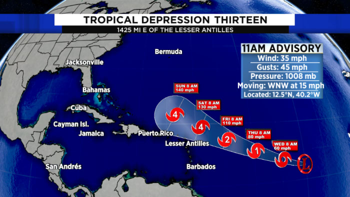
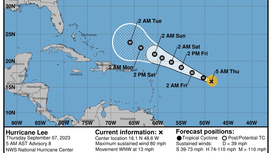
Post-Tropical Cyclone Rina Public Advisory
www.nhc.noaa.gov
BULLETIN
Tropical Depression Thirteen Advisory Number 1
NWS National Hurricane Center Miami FL AL132023
1100 AM AST Tue Sep 05 2023
...NEW TROPICAL DEPRESSION FORMS IN THE CENTRAL TROPICAL ATLANTIC...
...FORECAST TO BECOME A POWERFUL HURRICANE BY THE END OF THE WEEK...