Found Deceased Australia - Russell Hill, 74, & Carol Clay, 72, Wonnangatta Valley, 20 Mar 2020 #5 *charges*

Status
Not open for further replies.
Hello Zanzibar
We discussed the Myrtleford gate a few times.
This post discusses the mobile coverage at the gate.
This post provides a map and also a discussion of timing. [Note: this post says VHF; the radio used is HF, as Motormik pointed out; and Mr Hill's antenna appears to be missing.]
There are other posts that discuss time lines, but, given all the discussion, this looks more or less feasible: [What do others think?]
20 March, 10am, estimated - Mr Hill and Ms Clay leave Howitt High Plains, where they camped 19 March. From here they head into the Wonnangatta Valley, via Zeka spur track.
12:30pm - estimated arrival Wonnangatta valley. [Howitt to Wonnangatta is abotu 26 km; Zeka is a rough track of some 23 km and takes about 2 1/2 hrs, at an average of about 10km, allowing for stops]
12:30pm - 14:00pm - set up camp (estimated: allowing 90 mins to do that.)
16:30: Mr Hill is seen flying his drone.
18:00 - 18:40 - Radio call.
18:40 - 19:00 - pack away antenna, etc
19:00 - 22:00 - likely time when Mr Hill and Ms Clay were killed.
22:00 - midnight - killer packs up his own camp, places bodies in vehicle for transport out of valley; torches Mr Hill's tent. This may have been the last thing done.
Midnight - 1:00 am - from campsite to Myrtleford gate. The vehicle is heard by other campers in the valley. They describe a petrol vehicle towing a trailer. This is a distance of some 18 km; it is ascending and although a reasonable track, the trip without a trailer can take in daylight, about 40 mins. On a night, with little moon, and possibly towing a trailer, it is likely to take close to an hour. [From a discussion on Reddit]
01:00 - 01:45 - driver executes a 30 point U-turn. In the dark.
01:45 - 02:30 - return to valley floor. It is not clear whether the vehicle runs along the track of the valley floor or avoid the valley and takes Riley's track [Any thoughts from readers?]
02:30 - 05:00 - The drive out of the valley to the Union Spur - Providence Spur likely to take about 2 1/2 hours.
05:00 - 06:00 - Bury bodies on Union Spure track, near Providence Spurt track turn off.
06:00 - 07:00 - Drive from burial site to Grant Historical Area exit. [It is likely less than an hour, but the person would need to stop, answer calls of nature etc.]
07:00 - Exit Grant Historical Area onto Dargo High Plains road.
07:30 - Vehicle snapped at Mt Hotham. It is 50 km from McMillan's road, the likely point where the vehicle joined the Dargo High Plains road.
There are likely other data points for vehicle after this but they have not been made public.


Thanks for the posts Arboreal!

I am pretty sure that when Russell made the radio call on March 20 they had just arrived in the valley and they hadn't set up camp yet....I could be wrong and i'll have to go back to see why I am thinking this...
 
Last edited:
Was speaking with someone who has camped there many times.
Spotlighting is illegal there and he says hunters shine their spotlights up and around the camp sights which piss off the campers. Russell had a whiz-bang Maverick drone which saw who was spotlighting.

The drone was shot down and is that why it’s missing and that is what started an altercation


True or false. Dunno.
 
Hello Zanzibar
We discussed the Myrtleford gate a few times.
This post discusses the mobile coverage at the gate.
This post provides a map and also a discussion of timing. [Note: this post says VHF; the radio used is HF, as Motormik pointed out; and Mr Hill's antenna appears to be missing.]
There are other posts that discuss time lines, but, given all the discussion, this looks more or less feasible: [What do others think?]
20 March, 10am, estimated - Mr Hill and Ms Clay leave Howitt High Plains, where they camped 19 March. From here they head into the Wonnangatta Valley, via Zeka spur track.
12:30pm - estimated arrival Wonnangatta valley. [Howitt to Wonnangatta is abotu 26 km; Zeka is a rough track of some 23 km and takes about 2 1/2 hrs, at an average of about 10km, allowing for stops]
12:30pm - 14:00pm - set up camp (estimated: allowing 90 mins to do that.)
16:30: Mr Hill is seen flying his drone.
18:00 - 18:40 - Radio call.
18:40 - 19:00 - pack away antenna, etc
19:00 - 22:00 - likely time when Mr Hill and Ms Clay were killed.
22:00 - midnight - killer packs up his own camp, places bodies in vehicle for transport out of valley; torches Mr Hill's tent. This may have been the last thing done.
Midnight - 1:00 am - from campsite to Myrtleford gate. The vehicle is heard by other campers in the valley. They describe a petrol vehicle towing a trailer. This is a distance of some 18 km; it is ascending and although a reasonable track, the trip without a trailer can take in daylight, about 40 mins. On a night, with little moon, and possibly towing a trailer, it is likely to take close to an hour. [From a discussion on Reddit]
01:00 - 01:45 - driver executes a 30 point U-turn. In the dark.
01:45 - 02:30 - return to valley floor. It is not clear whether the vehicle runs along the track of the valley floor or avoid the valley and takes Riley's track [Any thoughts from readers?]
02:30 - 05:00 - The drive out of the valley to the Union Spur - Providence Spur likely to take about 2 1/2 hours.
05:00 - 06:00 - Bury bodies on Union Spure track, near Providence Spurt track turn off.
06:00 - 07:00 - Drive from burial site to Grant Historical Area exit. [It is likely less than an hour, but the person would need to stop, answer calls of nature etc.]
07:00 - Exit Grant Historical Area onto Dargo High Plains road.
07:30 - Vehicle snapped at Mt Hotham. It is 50 km from McMillan's road, the likely point where the vehicle joined the Dargo High Plains road.
There are likely other data points for vehicle after this but they have not been made public.

Hi Arboreal,

Great minds think alike! I've just been procrastinating about studying and did a timeline myself :) It's a great way to sort out the details.

I have been along for the ride whilst all the discussion around the Myrtelford gate and phone coverage etc however didn't think there was a location pinpointed for the gate? I'm thinking it was the first switchback just past the Myrtelford Turn-off Camp Ground? Do you have confirmation of a location?

Regarding phone coverage, as much as the coverage maps indicate coverage, there are large areas in there that don't have coverage (as indicated in the Under Investigation tv show) and also from local knowledge, much of the landscape has you in a coverage shadow in the mountains, hence why there aren't a lot of pings away from the Dargo High Plains Rd.

Your timeline is great, although there are a couple of points for discussion.

How did you come to 2.5hrs on the Zeka Spur Track, I think from Motomike? My timelines on the drives are different to yours and solely based on Google, which no doubt don't take into account the difficulty although are normally pretty good up here in the mountains. Have you other sources for these?

The timing of the drone - where did the 4.30pm time frame come from? I hadn't heard timing, just "evening" and presumed it was later.

Rileys Track - depending on where the Myrtleford Gate is (I'm sorry I've looked on here for mention of it but can't find it), Rileys Track may be inacessible.

The camera that took his photo I thought was on the Great Alpine Road west of the Dargo High Plains / Great Alpine Road intersection and well away from McMillans Rd, however I could be wrong! Perhaps Brumby Jack could help here as he was talking about the location (again sorry but I couldn't find it on the very lengthy threads). If it is where I thought then his timeline would be earlier than you have suggested.

I agree regarding the timeframe for when the altercation took place, if sunset was 7:24pm and they still had boots on (Under Investigation) it was likely before bedtime. His car was also seen at the camp site that night (to pack up the bodies?)

What intrigues me though is what is not reported.. no reports of gun shots (could be a crossbow - often used for deer hunting), no screams or sounds of an altercation, no report of the fire (considering we'd just had the worst fires in living memory for some parts and we were all a bit toey about fire thats a bit weird, maybe before sunset? Which would bring the whole thing forward).

And.... why the credit cards, debit cards and cash missing and the wallet contents loose in the floor well of the locked car?
 
My latest curiosity is why the 4WD was changed from white to blue. I've been thinking that from the first time I heard it.

Could be a pattern there.

Hi everyone. Long time lurker, first time posting.

This has also troubled me since the arrest. And also the fact that it appears Vic Roads may not have been notified of either colour change, as a rego check on the vehicle says it is still white. It's a very simple process to notify Vic Roads of a vehicle colour change - and the vehicle does not need to be inspected. Why would you not notify Vic Roads of a vehicle colour change... twice.

Red flags right there for me.
 
I don't know about the lady in Doha but after GL left Lisa, he was living in SA with a lady and they had a baby daughter together. She must have been born in 2001.
Not sure if I am able to ask this question……any clues as to the airline he worked for 1 year? Apologies if this is not appropriate.
 
@Arboreal
I think may help to understand the timing of movements.

https://www.facebook.com/watch/?v=231664508081482
Hi Bats
Thanks for your comment and the link to FB, which I can't access as I do not commune with that devil! ;)
I'd be interested learning more about when Mr Hill made camp. The reason I estimated that time was that a witness saw him flying a drone at 4:30 about. Motomike made an estimation on how long it took to set up, including erecting an antenna; about 90mins for a cam and maybe 10 mins for the antenna. Given the radio call commenced at 18:00, and Mr Hill was seen flying the drone at about 16:30 then it looks unlikely. But, the police said they thought he arrived there "late in the day" but have not said why. From the description given of Mr Hill, by the press an, in programs on the TV by his friends and by Motomike, I think Mr Hill would set up before flying his drone. It may be that the sighting and timing of Mr Hill flying his drone is wrong, or that he did fly it before setting up.
 
Hi Arboreal,

Great minds think alike! I've just been procrastinating about studying and did a timeline myself :) It's a great way to sort out the details.

I have been along for the ride whilst all the discussion around the Myrtelford gate and phone coverage etc however didn't think there was a location pinpointed for the gate? I'm thinking it was the first switchback just past the Myrtelford Turn-off Camp Ground? Do you have confirmation of a location?

Regarding phone coverage, as much as the coverage maps indicate coverage, there are large areas in there that don't have coverage (as indicated in the Under Investigation tv show) and also from local knowledge, much of the landscape has you in a coverage shadow in the mountains, hence why there aren't a lot of pings away from the Dargo High Plains Rd.

Your timeline is great, although there are a couple of points for discussion.

How did you come to 2.5hrs on the Zeka Spur Track, I think from Motomike? My timelines on the drives are different to yours and solely based on Google, which no doubt don't take into account the difficulty although are normally pretty good up here in the mountains. Have you other sources for these?

The timing of the drone - where did the 4.30pm time frame come from? I hadn't heard timing, just "evening" and presumed it was later.

Rileys Track - depending on where the Myrtleford Gate is (I'm sorry I've looked on here for mention of it but can't find it), Rileys Track may be inacessible.

The camera that took his photo I thought was on the Great Alpine Road west of the Dargo High Plains / Great Alpine Road intersection and well away from McMillans Rd, however I could be wrong! Perhaps Brumby Jack could help here as he was talking about the location (again sorry but I couldn't find it on the very lengthy threads). If it is where I thought then his timeline would be earlier than you have suggested.

I agree regarding the timeframe for when the altercation took place, if sunset was 7:24pm and they still had boots on (Under Investigation) it was likely before bedtime. His car was also seen at the camp site that night (to pack up the bodies?)

What intrigues me though is what is not reported.. no reports of gun shots (could be a crossbow - often used for deer hunting), no screams or sounds of an altercation, no report of the fire (considering we'd just had the worst fires in living memory for some parts and we were all a bit toey about fire thats a bit weird, maybe before sunset? Which would bring the whole thing forward).

And.... why the credit cards, debit cards and cash missing and the wallet contents loose in the floor well of the locked car?
upload_2021-12-2_13-10-4.png

Perhaps robbery was a motive or perhaps this was staged to look like a robbery?

Some interesting points in this article.

Leaving an invisible trail: how killers cover up their crimes | How to solve a murder: a detective's dilemma | The Guardian
 
Hi Bats
Thanks for your comment and the link to FB, which I can't access as I do not commune with that devil! ;)
I'd be interested learning more about when Mr Hill made camp. The reason I estimated that time was that a witness saw him flying a drone at 4:30 about. Motomike made an estimation on how long it took to set up, including erecting an antenna; about 90mins for a cam and maybe 10 mins for the antenna. Given the radio call commenced at 18:00, and Mr Hill was seen flying the drone at about 16:30 then it looks unlikely. But, the police said they thought he arrived there "late in the day" but have not said why. From the description given of Mr Hill, by the press an, in programs on the TV by his friends and by Motomike, I think Mr Hill would set up before flying his drone. It may be that the sighting and timing of Mr Hill flying his drone is wrong, or that he did fly it before setting up.

Haha...fair enough....well I have succumbed to the devil (FB) and we have a tenuous relationship sometimes! :D

Detective Stamper says in the video ... RH, when speaking to the HAM radio guys told them that he was in the process of setting up his camp and couldn't talk for too long as he needed to set up before it was too dark.
 
Maybe..... GL was up to some SK activities ie. stalking, spying on someone etc... and Russell inadvertently flew his drone over him, now GL is all paranoid and tracks down Russell and Carol resulting in a messy altercation involving the campsite.

I just think if GL was a SK then it wouldn't make sense to burn up the campsite because it screams out 'a crime has been committed'!

Although I guess if he was a SK then he might not be the planning, stalking type, rather someone who can't control his rage who reactively murders...

IMO
 
Hi Arboreal,

Great minds think alike! I've just been procrastinating about studying and did a timeline myself :) It's a great way to sort out the details.

I have been along for the ride whilst all the discussion around the Myrtelford gate and phone coverage etc however didn't think there was a location pinpointed for the gate? I'm thinking it was the first switchback just past the Myrtelford Turn-off Camp Ground? Do you have confirmation of a location?

Regarding phone coverage, as much as the coverage maps indicate coverage, there are large areas in there that don't have coverage (as indicated in the Under Investigation tv show) and also from local knowledge, much of the landscape has you in a coverage shadow in the mountains, hence why there aren't a lot of pings away from the Dargo High Plains Rd.

Your timeline is great, although there are a couple of points for discussion.

How did you come to 2.5hrs on the Zeka Spur Track, I think from Motomike? My timelines on the drives are different to yours and solely based on Google, which no doubt don't take into account the difficulty although are normally pretty good up here in the mountains. Have you other sources for these?

The timing of the drone - where did the 4.30pm time frame come from? I hadn't heard timing, just "evening" and presumed it was later.

Rileys Track - depending on where the Myrtleford Gate is (I'm sorry I've looked on here for mention of it but can't find it), Rileys Track may be inacessible.

The camera that took his photo I thought was on the Great Alpine Road west of the Dargo High Plains / Great Alpine Road intersection and well away from McMillans Rd, however I could be wrong! Perhaps Brumby Jack could help here as he was talking about the location (again sorry but I couldn't find it on the very lengthy threads). If it is where I thought then his timeline would be earlier than you have suggested.

I agree regarding the timeframe for when the altercation took place, if sunset was 7:24pm and they still had boots on (Under Investigation) it was likely before bedtime. His car was also seen at the camp site that night (to pack up the bodies?)

What intrigues me though is what is not reported.. no reports of gun shots (could be a crossbow - often used for deer hunting), no screams or sounds of an altercation, no report of the fire (considering we'd just had the worst fires in living memory for some parts and we were all a bit toey about fire thats a bit weird, maybe before sunset? Which would bring the whole thing forward).

And.... why the credit cards, debit cards and cash missing and the wallet contents loose in the floor well of the locked car?

Hey Zanzibar,
Thanks for your reply. Heaps of really good questions. I'll try to answer them....
Myrtleford gate location. Brumby Jack provided details, but I can't remember who said it was about 50m down from the crossroads, effectively preventing access to any of the other exit tracks.
Regarding phone coverage. Agreed. But the area around the Myrtleford gate is recorded as being in coverage, because it is high ground. Where the tower is, I have no idea.
How did you come to 2.5hrs on the Zeka Spur Track. Correct. Motomike. And also knowing that Mr Hill had a drone he might like to fly, thathe did not push himself along those tracks, but was slow and careful (according to friends speaking on TV) and being an older chap he may need to "use the convenience" a little more frequently than younger fellows.
The timing of the drone - where did the 4.30pm time frame: the "witness" spoken to by ch.9, ACA. I posted the reporter's words, verbatim, on the site. I think I provded a link. I think it was JudgeJudi who found the report. That whole issue arose from a discussion here of a HS article that was confusingly worded, see this and this. The press was saying "evening" but given the radio call ended at about 18:40 with Mr Hill saying it was getting dark, then the drone flying is only likely to have occurred before say 17:50, given ten mins to set up the antenna (Motomike info). That more or less fits with the 16:30 sighting and casts doubt on the flying it in the evening. Remember sunset was about 19:20 and somewhat earlier in the valley, possibly around 19:00.
Rileys Track - depending on where the Myrtleford Gate. I am not familiar iwth the area and hope that Brumby Jack or Motomike may clarify that point. But according to Google Maps, East Riley is inaccessible because of the location of the Myrtleford gate, as I think Brumby Jack or Motomike said in a post.
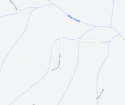
Riley's Track is further down the Wonnangatta track, towards the valley, and likely accessible but how drivable, I do not know: that requires local knowledge. See maps below.
The camera that took his photo: What photo is that?
What intrigues me though is what is not reported...: Agreed. I do not think firearms were involved. It could be a crossbow, but that has not been mentioned. My bet is the ever present "blunt instrument" and possibly a hunting knife. I'll leave the rest to your imagination. But I suspect the tent was a bit of a mess and there was blood etc over much of the camping gear, along with the perpetrator's finger prints nad DNA. He may have been sitting, having a cuppa or a beer and things got out of hand.
I suspect the fire was set about 11:15 and that some accelerant was used along with forest debris, like leaves and twigs. Under Investigation shows that to get the tent to burn to that extent you need constant flame and fuel. the "buchworker/blackberry remover was camped about 500 m away, I recall reading, so I am surprised he did not smell the fire. Moreover, people say they heard a petrol driven 4WD leaving, towing a trailer. Some even say it was the blue Nissan. How they make that identification, I do not know. Again, just a suspicion, but when the engine started people woke up and some may have seen the headlights. But if they did wake and the fire was still high, they may well have seen it flickering. So, the conjecture is the fire was out or at least just smouldering when the man left. Of course, he may have tipped water on it, in an act of good citizenship!
And.... why the credit cards?: I think that is a red herring, to make it look like robbery.
I should say that the timing is very flexible and it is only a start. I agree: one should always do a time line. Time flows only in one direction. (Except in Dr Who and Star Trek).

upload_2021-12-2_13-53-48.png

upload_2021-12-2_13-42-49.png
 
Haha...fair enough....well I have succumbed to the devil (FB) and we have a tenuous relationship sometimes! :D

Detective Stamper says in the video ... RH, when speaking to the HAM radio guys told them that he was in the process of setting up his camp and couldn't talk for too long as he needed to set up before it was too dark.
OK. That is very interesting. Motomike was on that call, actually speaking to Mr Russell, and has not mentioned that.
 
Status
Not open for further replies.

Members online

Online statistics

Members online
80
Guests online
3,943
Total visitors
4,023

Forum statistics

Threads
593,502
Messages
17,988,217
Members
229,151
Latest member
hongwuzhiye59
Back
Top