SouthAussie
Well-Known Member
- Joined
- Aug 9, 2012
- Messages
- 29,287
- Reaction score
- 175,992
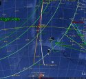
THOUGH, IMO, it does seem that MH370 avoided flying over the Indonesian Island of Sumatra and/or Indonesian airspace on its final flight southward
RSBM
I wonder how wide of a turn the plane would have had to make to go back in a magnetic south direction. And would this wide turn naturally have taken them around Sumatra, and not over it?
I don't imagine a large commercial aircraft could make a quick zippy turn if the AP had been programmed to head south when a hypoxiated pilot/co-pilot realised their ailing plane was heading for a highly populated area like India.
:dunno: